- Bethel, Minnesota
Infobox Settlement
official_name = Bethel, Minnesota
settlement_type =City
nickname =
motto =
imagesize =
image_caption =
image_
imagesize =
image_caption =
image_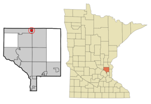
mapsize = 250px
map_caption = Location of Bethel, Minnesota
mapsize1 =
map_caption1 =subdivision_type = Country
subdivision_name =United States
subdivision_type1 = State
subdivision_name1 =Minnesota
subdivision_type2 = County
subdivision_name2 = Anokagovernment_footnotes =
government_type =
leader_title =
leader_name =
leader_title1 =
leader_name1 =
established_title =
established_date =unit_pref = Imperial
area_footnotes =area_magnitude =
area_total_km2 = 2.4
area_land_km2 = 2.2
area_water_km2 = 0.1
area_total_sq_mi = 0.9
area_land_sq_mi = 0.9
area_water_sq_mi = 0.1population_as_of = 2000
population_footnotes =
population_total = 443
population_density_km2 = 198.5
population_density_sq_mi = 514.1timezone = Central (CST)
utc_offset = -6
timezone_DST = CDT
utc_offset_DST = -5
elevation_footnotes =
elevation_m = 284
elevation_ft = 932
latd = 45 |latm = 24 |lats = 8 |latNS = N
longd = 93 |longm = 16 |longs = 4 |longEW = Wpostal_code_type =
ZIP code
postal_code = 55005
area_code = 763
blank_name = FIPS code
blank_info = 27-05554GR|2
blank1_name = GNIS feature ID
blank1_info = 0640014GR|3
website =
footnotes =Bethel is a city in Anoka County,
Minnesota ,United States . The population was 443 at the 2000 census.Geography
According to the
United States Census Bureau , the city has a total area of 0.9square mile s (2.4km² ), of which, 0.9 square miles (2.2 km²) of it is land and 0.1 square miles (0.2 km²) of it (6.52%) is water. 237th Avenue / County 24 serves as a main route in the community.Minnesota State Highway 65 is nearby.Adjacent cities
*East Bethel (east)
*St. Francis (west, south, north)Demographics
As of the
census GR|2 of 2000, there were 443 people, 149 households, and 108 families residing in the city. Thepopulation density was 514.1 people per square mile (198.9/km²). There were 155 housing units at an average density of 179.9/sq mi (69.6/km²). The racial makeup of the city was 96.39% White, 0.23% African American, 0.23% Native American, 0.23% Asian, 0.23% from other races, and 2.71% from two or more races. Hispanic or Latino of any race were 2.26% of the population.There were 149 households out of which 47.7% had children under the age of 18 living with them, 56.4% were married couples living together, 7.4% had a female householder with no husband present, and 27.5% were non-families. 18.1% of all households were made up of individuals and 3.4% had someone living alone who was 65 years of age or older. The average household size was 2.97 and the average family size was 3.46.
In the city the population was spread out with 36.1% under the age of 18, 7.0% from 18 to 24, 39.7% from 25 to 44, 13.3% from 45 to 64, and 3.8% who were 65 years of age or older. The median age was 30 years. For every 100 females there were 113.0 males. For every 100 females age 18 and over, there were 121.1 males.
The median income for a household in the city was $45,125, and the median income for a family was $50,500. Males had a median income of $36,406 versus $25,625 for females. The
per capita income for the city was $16,399. About 4.5% of families and 6.4% of the population were below thepoverty line , including 4.0% of those under age 18 and 9.1% of those age 65 or over.References
Wikimedia Foundation. 2010.