- Lexington, Michigan
Infobox Settlement
official_name = Lexington, Michigan
settlement_type = Village
nickname =
motto =
imagesize =
image_caption =
image_
imagesize =
image_caption =
image_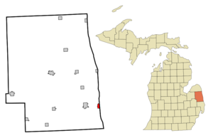
mapsize = 250px
map_caption = Location of Lexington, Michigan
mapsize1 =
map_caption1 =subdivision_type = Country
subdivision_name =United States
subdivision_type1 = State
subdivision_name1 =Michigan
subdivision_type2 = County
subdivision_name2 = Sanilacgovernment_footnotes =
government_type =
leader_title =
leader_name =
leader_title1 =
leader_name1 =
established_title =
established_date =area_footnotes =
area_magnitude =
area_total_km2 = 2.4
area_land_km2 = 2.4
area_water_km2 = 0.0
area_total_sq_mi = 0.9
area_land_sq_mi = 0.9
area_water_sq_mi = 0.0population_as_of = 2000
population_footnotes =
population_total = 1104
population_density_km2 = 458.8
population_density_sq_mi = 1188.3timezone = Eastern (EST)
utc_offset = -5
timezone_DST = EDT
utc_offset_DST = -4
elevation_footnotes =
elevation_m = 188
elevation_ft = 617
latd = 43 |latm = 16 |lats = 7 |latNS = N
longd = 82 |longm = 32 |longs = 1 |longEW = Wpostal_code_type =
ZIP code
postal_code = 48450
area_code = 810
blank_name = FIPS code
blank_info = 26-47280GR|2
blank1_name = GNIS feature ID
blank1_info = 0630359GR|3
website =
footnotes =Lexington is a village in Sanilac County in the
U.S. state ofMichigan . The population was 1,104 at the 2000 census. The village is located within Lexington Township.Lexington refers to itself as "The First Resort North"Fact|date=January 2008 because of the high number of tourists it attracts during its summer months.Fact|date=January 2008
During the summer months, Lexington takes part in a Music In The Park progam, which is very popular and attracts many tourists to the area.Fact|date=January 2008
Geography
*According to the
United States Census Bureau , the village has a total area of 0.9square mile s (2.4km² ), all land
*It is considered to be part ofthe Thumb ofMichigan , which in turn is a subregion of theFlint/Tri-Cities .Demographics
As of the
census GR|2 of 2000, there were 1,104 people, 550 households, and 305 families residing in the village. Thepopulation density was 1,188.3 per square mile (458.3/km²). There were 1,060 housing units at an average density of 1,140.9/sq mi (440.1/km²). The racial makeup of the village was 98.82% White, 0.18% Native American, 0.36% Asian, 0.18% from other races, and 0.45% from two or more races. Hispanic or Latino of any race were 1.54% of the population.There were 550 households out of which 21.8% had children under the age of 18 living with them, 43.8% were married couples living together, 7.8% had a female householder with no husband present, and 44.5% were non-families. 40.7% of all households were made up of individuals and 20.2% had someone living alone who was 65 years of age or older. The average household size was 1.98 and the average family size was 2.65.
In the village the population was spread out with 20.0% under the age of 18, 6.7% from 18 to 24, 20.2% from 25 to 44, 26.1% from 45 to 64, and 27.0% who were 65 years of age or older. The median age was 47 years. For every 100 females there were 81.9 males. For every 100 females age 18 and over, there were 74.9 males.
The median income for a household in the village was $30,792, and the median income for a family was $41,364. Males had a median income of $36,346 versus $25,809 for females. The
per capita income for the village was $22,218. About 7.3% of families and 9.4% of the population were below thepoverty line , including 12.0% of those under age 18 and 5.4% of those age 65 or over.References
External links
Wikimedia Foundation. 2010.