- Orogrande, New Mexico
-
Orogrande is an unincorporated community in Otero County, New Mexico in the United States, located at latitude of 32.37111 and a longitude of -106.08389 in the Jarilla Mountains of the Tularosa Basin on U.S. 54 between El Paso, Texas and Alamogordo, New Mexico. Originally a mining town named Jarilla Junction due to its proximity to the Jarilla Mountains established in 1905, the town was renamed Orogrande (Spanish for big gold) in 1906 and is not far from similar mining towns (now completely abandoned ghost towns) named Brice and Ohaysi. [1] The population exploded to approximately 2000 as the result of a gold rush that occurred in 1905, but quickly collapsed almost to the point of depopulation when the gold deposits proved much less abundant than expected. [2] There are still numerous abandoned mines in the area which fall under the jurisdiction of the Bureau of Land Management.[3] Other land around Orogrande is part of a military reservation under the control of Fort Bliss.
The community had a population of 52 in the 2010 census. [4]. It is served by a post office and has the zip code 88342.
References
- ^ http://geoinfo.nmt.edu/publications/periodicals/litegeology/15/lite-geo_15_spring_1996.pdf
- ^ http://www.ghosttowns.com/states/nm/orogrande.html
- ^ Orogrande and the Jarilla Mountains
- ^ http://factfinder2.census.gov
External links
Coordinates: 32°22′16″N 106°05′04″W / 32.37111°N 106.08444°W
Municipalities and communities of Otero County, New Mexico City 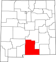
Villages CDPs Unincorporated
communitiesHigh Rolls | Mayhill | Mountain Park | Newman | Orogrande | Piñon | Sunspot | Weed | Three Rivers
Indian reservation Mescalero Apache Indian Reservation
Categories:- Populated places in Otero County, New Mexico
- Unincorporated communities in New Mexico

Wikimedia Foundation. 2010.