- Mayhill, New Mexico
-
Mayhill, New Mexico Location within the state of New Mexico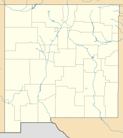
 Mayhill, New Mexico
Coordinates: 32°53′23″N 105°28′41″W / 32.88972°N 105.47806°W Country United States State New Mexico County Otero Elevation 6,581 ft (2,006 m) Time zone MST (UTC-7) - Summer (DST) MDT (UTC-6) Mayhill is a small unincorporated community in Otero County, New Mexico, United States. It is surrounded by the Lincoln National Forest on the eastern slope of the Sacramento Mountains, at the confluence of James Canyon and Rio Penasco, about 17 miles east of Cloudcroft.[1] Elevation is 6581 feet. Mayhill includes a post office, a restaurant, and a couple of gas stations. The village is almost entirely residential, consisting largely of vacation homes and summer cabins. Farming and ranching are also important economic activities in the area.[2]
References
Municipalities and communities of Otero County, New Mexico County seat: Alamogordo City 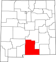
Villages CDPs Unincorporated
communitiesHigh Rolls | Mayhill | Mountain Park | Newman | Orogrande | Piñon | Sunspot | Weed | Three Rivers
Indian reservation Mescalero Apache Indian Reservation
Coordinates: 32°53′23″N 105°28′41″W / 32.88972°N 105.47806°W
Categories:- Unincorporated communities in New Mexico
- Populated places in Otero County, New Mexico
- New Mexico geography stubs


Wikimedia Foundation. 2010.