- Monroe Township, Madison County, Indiana
-
Monroe Township — Township — Location in Madison County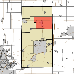
Coordinates: 40°15′52″N 85°39′28″W / 40.26444°N 85.65778°WCoordinates: 40°15′52″N 85°39′28″W / 40.26444°N 85.65778°W Country  United States
State  Indiana
County Madison Government – Type Indiana township Area – Total 51.28 sq mi (132.82 km2) – Land 51.26 sq mi (132.75 km2) – Water 0.02 sq mi (0.06 km2) 0.05% Elevation 873 ft (266 m) Population (2000) – Total 10,233 – Density 199.6/sq mi (77.1/km2) ZIP codes 46001, 46063, 46070 GNIS feature ID 0453642 Monroe Township is one of fourteen townships in Madison County, Indiana, USA. As of the 2000 census, its population was 10,233.[1]
Contents
Geography
According to the United States Census Bureau, Monroe Township covers an area of 51.28 square miles (132.8 km2); of this, 51.26 square miles (132.8 km2) (99.95 percent) is land and 0.02 square miles (0.052 km2) (0.05 percent) is water.
Cities, towns, villages
Unincorporated towns
- Gehring and Gumz Ditch at 40°14′04″N 85°34′42″W / 40.2344862°N 85.5783071°W
- Gimco City at 40°15′30″N 85°41′02″W / 40.2583738°N 85.6838648°W
(This list is based on USGS data and may include former settlements.)
Cemeteries
The township contains these six cemeteries: Bell, Donahue, Parkview, Pisgah, Star and Walker.
Major highways
Airports and landing strips
- Alexandria Airport
School districts
- Alexandria Community School Corporation
Political districts
- Indiana's 6th congressional district
- State House District 35
- State House District 36
- State Senate District 25
References
- "Monroe Township, Madison County, Indiana". Geographic Names Information System, U.S. Geological Survey. http://geonames.usgs.gov/pls/gnispublic/f?p=gnispq:3:::NO::P3_FID:0453642. Retrieved 2009-10-03.
- United States Census Bureau 2008 TIGER/Line Shapefiles
- IndianaMap
External links
- Indiana Township Association
- United Township Association of Indiana
- City-Data.com page for Monroe Township
- Monroe Township history
Municipalities and communities of Madison County, Indiana Cities Alexandria | Anderson | Elwood‡

Towns Chesterfield‡ | Country Club Heights | Edgewood | Frankton | Ingalls | Lapel | Markleville | Orestes | Pendleton | River Forest | Summitville | Woodlawn Heights
Townships Adams | Anderson | Boone | Duck Creek | Fall Creek | Green | Jackson | Lafayette | Monroe | Pipe Creek | Richland | Stony Creek | Union | Van Buren
Unincorporated
communitiesAlfont | Alliance | Bloomer | College Corner | Dundee | Edgewood Village | Emporia | Fishersburg | Florida | Gridley | Hamilton | Hardscrabble | Huntsville | Leisure | Linwood | Moonville | New Columbus | Perkinsville | Prosperity | Rigdon | Sunview
Footnotes ‡This populated place also has portions in an adjacent county or counties
Categories:- Townships in Madison County, Indiana


Wikimedia Foundation. 2010.