- Powers, Michigan
Infobox Settlement
official_name = Powers, Michigan
settlement_type = Village
nickname =
motto =
imagesize =
image_caption =
image_
imagesize =
image_caption =
image_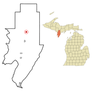
mapsize = 250px
map_caption = Location of Powers, Michigan
mapsize1 =
map_caption1 =subdivision_type = Country
subdivision_name =United States
subdivision_type1 = State
subdivision_name1 =Michigan
subdivision_type2 = County
subdivision_name2 = Menomineegovernment_footnotes =
government_type =
leader_title =
leader_name =
leader_title1 =
leader_name1 =
established_title =
established_date =area_footnotes =
area_magnitude =
area_total_km2 = 2.6
area_land_km2 = 2.6
area_water_km2 = 0.0
area_total_sq_mi = 1.0
area_land_sq_mi = 1.0
area_water_sq_mi = 0.0population_as_of = 2000
population_footnotes =
population_total = 430
population_density_km2 = 167.5
population_density_sq_mi = 433.8timezone = Central (CST)
utc_offset = -6
timezone_DST = CDT
utc_offset_DST = -5
elevation_footnotes =
elevation_m = 267
elevation_ft = 876
latd = 45 |latm = 41 |lats = 24 |latNS = N
longd = 87 |longm = 31 |longs = 31 |longEW = Wpostal_code_type =
ZIP code
postal_code = 49874
area_code = 906
blank_name = FIPS code
blank_info = 26-66140GR|2
blank1_name = GNIS feature ID
blank1_info = 0635379GR|3
website =
footnotes =Powers is a village in Menominee County in the
U.S. state ofMichigan . The population was 430 at the 2000 census. It was named for John Powers, a bookkeeper for a logging company that came into the area in the late 19th century.Geography
According to the
United States Census Bureau , the village has a total area of 1.0square mile s (2.6km² ), all land.Demographics
As of the
census GR|2 of 2000, there were 430 people, 124 households, and 59 families residing in the village. Thepopulation density was 433.8 per square mile (167.7/km²). There were 146 housing units at an average density of 147.3/sq mi (56.9/km²). The racial makeup of the village was 97.67% White, 0.47% Native American, and 1.86% from two or more races.There were 124 households out of which 14.5% had children under the age of 18 living with them, 40.3% were married couples living together, 5.6% had a female householder with no husband present, and 52.4% were non-families. 45.2% of all households were made up of individuals and 28.2% had someone living alone who was 65 years of age or older. The average household size was 2.08 and the average family size was 2.85.
In the village the population was spread out with 9.5% under the age of 18, 5.6% from 18 to 24, 13.7% from 25 to 44, 16.7% from 45 to 64, and 54.4% who were 65 years of age or older. The median age was 68 years. For every 100 females there were 62.3 males. For every 100 females age 18 and over, there were 60.1 males.
The median income for a household in the village was $20,250, and the median income for a family was $36,250. Males had a median income of $25,000 versus $20,625 for females. The
per capita income for the village was $14,207. About 14.6% of families and 17.9% of the population were below thepoverty line , including 19.0% of those under age 18 and 24.2% of those age 65 or over.References
Wikimedia Foundation. 2010.