- Free Soil, Michigan
Infobox Settlement
official_name = Free Soil, Michigan
settlement_type = Village
nickname =
motto =
imagesize =
image_caption =
image_
imagesize =
image_caption =
image_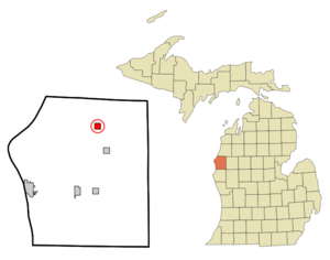
mapsize = 250px
map_caption = Location of Free Soil, Michigan
mapsize1 =
map_caption1 =subdivision_type = Country
subdivision_name =United States
subdivision_type1 = State
subdivision_name1 =Michigan
subdivision_type2 = County
subdivision_name2 = Masongovernment_footnotes =
government_type =
leader_title =
leader_name =
leader_title1 =
leader_name1 =
established_title =
established_date =area_footnotes =
area_magnitude =
area_total_km2 = 2.7
area_land_km2 = 2.7
area_water_km2 = 0.0
area_total_sq_mi = 1.0
area_land_sq_mi = 1.0
area_water_sq_mi = 0.0population_as_of = 2000
population_footnotes =
population_total = 177
population_density_km2 = 66.1
population_density_sq_mi = 171.2timezone = Eastern (EST)
utc_offset = -5
timezone_DST = EDT
utc_offset_DST = -4
elevation_footnotes =
elevation_m = 209
elevation_ft = 686
latd = 44 |latm = 6 |lats = 28 |latNS = N
longd = 86 |longm = 12 |longs = 57 |longEW = Wpostal_code_type =
ZIP code
postal_code = 49411
area_code = 231
blank_name = FIPS code
blank_info = 26-30600GR|2
blank1_name = GNIS feature ID
blank1_info = 1617399GR|3
website =
footnotes =Free Soil is a village in Mason County of the
U.S. state ofMichigan .. As of the 2000 census, the village population was 177. The village is located within Free Soil Township. The village is close to the intersection of Freesoil and Custer Roads. Freesoil operates a one-building K-8 school. It was previously K-12, with the last graduating class in 2007.Geography
According to the
United States Census Bureau , the village has a total area of 1.0square mile s (2.7km² ), all land. The Sauble River runs just East of the village.The current village is actually the second settlement in Mason County to be named Freesoil. An area in Grant Township near Lake Michigan, just south of the Manistee County line, was the original settlement in the late 1800's. There are still a few homes in the area now known as "Old Freesoil".
Demographics
As of the
census GR|2 of 2000, there were 177 people, 75 households, and 48 families residing in the village. Thepopulation density was 171.2 per square mile (66.3/km²). There were 93 housing units at an average density of 90.0/sq mi (34.9/km²). The racial makeup of the village was 93.22% White, 2.26% African American, 0.56% Native American, and 3.95% from two or more races.There were 75 households out of which 25.3% had children under the age of 18 living with them, 53.3% were married couples living together, 6.7% had a female householder with no husband present, and 36.0% were non-families. 36.0% of all households were made up of individuals and 16.0% had someone living alone who was 65 years of age or older. The average household size was 2.36 and the average family size was 3.02.
In the village the population was spread out with 22.6% under the age of 18, 9.6% from 18 to 24, 27.7% from 25 to 44, 22.6% from 45 to 64, and 17.5% who were 65 years of age or older. The median age was 40 years. For every 100 females there were 98.9 males. For every 100 females age 18 and over, there were 98.6 males.
The median income for a household in the village was $27,083, and the median income for a family was $36,000. Males had a median income of $28,750 versus $20,833 for females. The
per capita income for the village was $13,329. About 5.6% of families and 9.8% of the population were below thepoverty line , including 9.8% of those under the age of eighteen and 11.4% of those sixty five or over.Recreation
The Sauble River provides great fishing for brown and brook trout, along with many other species. It is also a fine river to canoe or tube. People frequently make the trek from Smitty's Landing to Stephens Rd.
Gun Lake, Hoague Lake, Blue Lake, and Thunder Lake are very close to Freesoil. They are excellent lakes for bass and panfish. Hoague Lake has a public access. Gun Lake has a boat launch and a public beach. Gun Lake is larger and more popular with recreational boaters.
The North Country trail crosses Freesoil Rd about five miles East of the village. It is popular with hikers, and it is one of the only portions of the trail open to mountain bikes.
There is a National Forest campground and recreation area on Lake Michigan to the West of Freesoil. It has miles of hiking and biking trails. It is also open to hunting during season.
Dining and Night Life
The Heidi Hof Tavern and the Sauble River Inn are popular restaurants in the Freesoil area. They offer full menus, pool tables, and live music. The Heidi Hof is on Freesoil Rd, and the Sauble River Inn is located on US 31. The Sauble River Inn also has lodging available for tourists, fishermen, and hunters.
References
Wikimedia Foundation. 2010.