- Grandville, Michigan
Infobox Settlement
official_name = Grandville, Michigan
settlement_type =City
nickname =
motto =
imagesize =
image_caption =
image_
imagesize =
image_caption =
image_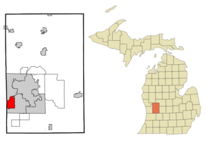
mapsize = 250x200px
map_caption = Location of Grandville, Michigan
mapsize1 =
map_caption1 =subdivision_type = Country
subdivision_name =United States
subdivision_type1 = State
subdivision_name1 =Michigan
subdivision_type2 = County
subdivision_name2 = Kentgovernment_footnotes =
government_type =
leader_title =
leader_name =
leader_title1 =
leader_name1 =
established_title =
established_date =unit_pref = Imperial
area_footnotes =area_magnitude =
area_total_km2 = 19.7
area_land_km2 = 19.2
area_water_km2 = 0.5
area_total_sq_mi = 7.6
area_land_sq_mi = 7.4
area_water_sq_mi = 0.2population_as_of = 2000
population_footnotes =
population_total = 16263
population_density_km2 = 847.7
population_density_sq_mi = 2195.6timezone = Eastern (EST)
utc_offset = -5
timezone_DST = EDT
utc_offset_DST = -4
elevation_footnotes =
elevation_m = 184
elevation_ft = 604
latd = 42 |latm = 54 |lats = 14 |latNS = N
longd = 85 |longm = 45 |longs = 27 |longEW = Wpostal_code_type =
ZIP code s
postal_code = 49418, 49468
area_code = 616
blank_name = FIPS code
blank_info = 26-34160GR|2
blank1_name = GNIS feature ID
blank1_info = 0627126GR|3
website =
footnotes =Grandville is a city in Kent County in the
U.S. state ofMichigan . The population was 16,263 at the 2000 census.Geography
According to the
United States Census Bureau , the city has a total area of 7.6square mile s (19.7km² ), of which, 7.4 square miles (19.2 km²) of it is land and 0.2 square miles (0.5 km²) of it (2.63%) is water.Demographics
As of the
census GR|2 of 2000, there were 16,263 people, 6,095 households, and 4,370 families residing in the city. Thepopulation density was 2,195.6 per square mile (847.4/km²). There were 6,279 housing units at an average density of 847.7/sq mi (327.2/km²). The racial makeup of the city was 94.94% White, 1.40% African American, 0.26% Native American, 1.16% Asian, 0.02% Pacific Islander, 0.87% from other races, and 1.34% from two or more races. Hispanic or Latino of any race were 3.08% of the population.There were 6,095 households out of which 37.0% had children under the age of 18 living with them, 58.9% were married couples living together, 9.8% had a female householder with no husband present, and 28.3% were non-families. 22.8% of all households were made up of individuals and 8.4% had someone living alone who was 65 years of age or older. The average household size was 2.64 and the average family size was 3.13.
In the city the population was spread out with 27.9% under the age of 18, 10.6% from 18 to 24, 28.0% from 25 to 44, 20.8% from 45 to 64, and 12.8% who were 65 years of age or older. The median age was 34 years. For every 100 females there were 94.7 males. For every 100 females age 18 and over, there were 90.2 males.
The median income for a household in the city was $47,570, and the median income for a family was $55,047. Males had a median income of $41,619 versus $26,350 for females. The
per capita income for the city was $21,306. About 3.2% of families and 4.5% of the population were below thepoverty line , including 3.7% of those under age 18 and 4.2% of those age 65 or over.ites of Interest
*
Mars Hill Bible Church , led by pastorRob Bell , is amegachurch .
*RiverTown Crossings is the largestshopping mall in the Grand Rapids area.Major highways
* M-11
* M-121, aka Chicago Drive
* I-196ee also
*
Wyoming, Michigan
*Grand Rapids, Michigan References
External links
* [http://www.cityofgrandville.com/ Grandville official website]
Wikimedia Foundation. 2010.