- Gaastra, Michigan
Infobox Settlement
official_name = Gaastra, Michigan
settlement_type =City
nickname =
motto =
imagesize =
image_caption =
image_
imagesize =
image_caption =
image_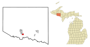
mapsize = 250px
map_caption = Location of Gaastra, Michigan
mapsize1 =
map_caption1 =subdivision_type = Country
subdivision_name =United States
subdivision_type1 = State
subdivision_name1 =Michigan
subdivision_type2 = County
subdivision_name2 = Irongovernment_footnotes =
government_type =
leader_title =
leader_name =
leader_title1 =
leader_name1 =
established_title =
established_date =unit_pref = Imperial
area_footnotes =area_magnitude =
area_total_km2 = 4.3
area_land_km2 = 4.3
area_water_km2 = 0.0
area_total_sq_mi = 1.6
area_land_sq_mi = 1.6
area_water_sq_mi = 0.0population_as_of = 2000
population_footnotes =
population_total = 339
population_density_km2 = 79.5
population_density_sq_mi = 205.9timezone = Central (CST)
utc_offset = -6
timezone_DST = CDT
utc_offset_DST = -5
elevation_footnotes =
elevation_m = 494
elevation_ft = 1621
latd = 46 |latm = 3 |lats = 35 |latNS = N
longd = 88 |longm = 36 |longs = 20 |longEW = Wpostal_code_type =
ZIP code
postal_code = 49927
area_code = 906
blank_name = FIPS code
blank_info = 26-31160GR|2
blank1_name = GNIS feature ID
blank1_info = 0626580GR|3
website =
footnotes =Gaastra is a city in Iron County in the
U.S. state ofMichigan . As of the 2000 census, the city population was 339. The city is named after Douwe Gaastra, a building contractor and real estate speculator who bought the land in October 1908 andplat ted the town. It was incorporated as a village in 1919 and as a city in 1949.cite book | last = Romig | first = Walter | year = 1986 | title = Michigan Place Names | origyear= 1973 | publisher = Wayne State University Press | location = Detroit, Michigan | id = ISBN 0-8143-1838-X] Bucky Holm is the current mayor of Gaastra.Geography
According to the
United States Census Bureau , the city has a total area of 1.6square mile s (4.3km² ), all land.Demographics
As of the
census GR|2 of 2000, there were 339 people, 146 households, and 102 families residing in the city. Thepopulation density was 205.9 per square mile (79.3/km²). There were 164 housing units at an average density of 99.6/sq mi (38.4/km²). The racial makeup of the city was 97.35% White, 0.59% Native American, 0.59% from other races, and 1.47% from two or more races. Hispanic or Latino of any race were 0.88% of the population. 22.0% were of Italian, 20.1% Polish, 13.9% Finnish, 10.6% French and 8.1% American ancestry according toCensus 2000 . 97.3% spoke English and 2.7% Polish as their first language.There were 146 households out of which 28.1% had children under the age of 18 living with them, 57.5% were married couples living together, 8.9% had a female householder with no husband present, and 30.1% were non-families. 30.1% of all households were made up of individuals and 19.9% had someone living alone who was 65 years of age or older. The average household size was 2.32 and the average family size was 2.87.
In the city the population was spread out with 24.5% under the age of 18, 6.8% from 18 to 24, 20.9% from 25 to 44, 20.9% from 45 to 64, and 26.8% who were 65 years of age or older. The median age was 44 years. For every 100 females there were 87.3 males. For every 100 females age 18 and over, there were 86.9 males.
The median income for a household in the city was $23,125, and the median income for a family was $35,521. Males had a median income of $24,750 versus $29,583 for females. The
per capita income for the city was $15,797. About 21.2% of families and 22.2% of the population were below thepoverty line , including 39.5% of those under age 18 and 10.9% of those age 65 or over.References
Wikimedia Foundation. 2010.