- Port Hope, Michigan
Infobox Settlement
official_name = Port Hope, Michigan
settlement_type = Village
nickname =
motto =
imagesize =
image_caption =
image_
imagesize =
image_caption =
image_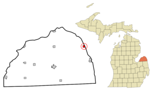
mapsize = 250px
map_caption = Location of Port Hope, Michigan
mapsize1 =
map_caption1 =subdivision_type = Country
subdivision_name =United States
subdivision_type1 = State
subdivision_name1 =Michigan
subdivision_type2 = County
subdivision_name2 = Hurongovernment_footnotes =
government_type =
leader_title =
leader_name =
leader_title1 =
leader_name1 =
established_title =
established_date =area_footnotes =
area_magnitude =
area_total_km2 = 2.6
area_land_km2 = 2.6
area_water_km2 = 0.0
area_total_sq_mi = 1.0
area_land_sq_mi = 1.0
area_water_sq_mi = 0.0population_as_of = 2000
population_footnotes =
population_total = 310
population_density_km2 = 119.2
population_density_sq_mi = 308.7timezone = Eastern (EST)
utc_offset = -5
timezone_DST = EDT
utc_offset_DST = -4
elevation_footnotes =
elevation_m = 185
elevation_ft = 607
latd = 43 |latm = 56 |lats = 27 |latNS = N
longd = 82 |longm = 42 |longs = 49 |longEW = Wpostal_code_type =
ZIP code
postal_code = 48468
area_code = 989
blank_name = FIPS code
blank_info = 26-65800GR|2
blank1_name = GNIS feature ID
blank1_info = 0635265GR|3
website =
footnotes =Port Hope is a village in Huron County of the
U.S. state ofMichigan . As of the 2000 census, the village population was 310. The village is within Rubicon Township.Geography
According to the
United States Census Bureau , the village has a total area of 1.0square mile s (2.6km² ), all land.Demographics
As of the
census GR|2 of 2000, there were 310 people, 132 households, and 95 families residing in the village. Thepopulation density was 308.7 per square mile (119.7/km²). There were 203 housing units at an average density of 202.2/sq mi (78.4/km²). The racial makeup of the village was 98.71% White and 1.29% Native American. Hispanic or Latino of any race were 0.32% of the population.There were 132 households out of which 24.2% had children under the age of 18 living with them, 61.4% were married couples living together, 7.6% had a female householder with no husband present, and 28.0% were non-families. 25.8% of all households were made up of individuals and 17.4% had someone living alone who was 65 years of age or older. The average household size was 2.32 and the average family size was 2.67.
In the village the population was spread out with 20.0% under the age of 18, 5.5% from 18 to 24, 20.3% from 25 to 44, 26.1% from 45 to 64, and 28.1% who were 65 years of age or older. The median age was 48 years. For every 100 females there were 96.2 males. For every 100 females age 18 and over, there were 101.6 males.
The median income for a household in the village was $31,071, and the median income for a family was $34,167. Males had a median income of $26,875 versus $18,125 for females. The
per capita income for the village was $16,428. About 5.6% of families and 4.6% of the population were below thepoverty line , including none of those under age 18 and 6.0% of those age 65 or over.Education
Port Hope High School's mascot is the Bluestars.
References
Wikimedia Foundation. 2010.