- Hubbell, Michigan
Infobox Settlement
official_name = Hubbell, Michigan
settlement_type = CDP
nickname =
motto =
imagesize =
image_caption =
image_
imagesize =
image_caption =
image_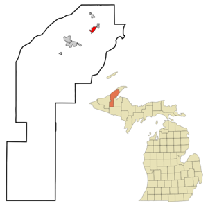
mapsize = 250px
map_caption = Location of Hubbell, Michigan
mapsize1 =
map_caption1 =subdivision_type = Country
subdivision_name =United States
subdivision_type1 = State
subdivision_name1 =Michigan
subdivision_type2 = County
subdivision_name2 = Houghtongovernment_footnotes =
government_type =
leader_title =
leader_name =
leader_title1 =
leader_name1 =
established_title =
established_date =unit_pref = Imperial
area_footnotes =area_magnitude =
area_total_km2 = 4.9
area_land_km2 = 4.8
area_water_km2 = 0.0
area_total_sq_mi = 1.9
area_land_sq_mi = 1.9
area_water_sq_mi = 0.0population_as_of = 2000
population_footnotes =
population_total = 1105
population_density_km2 = 228.7
population_density_sq_mi = 592.2timezone = Eastern (EST)
utc_offset = -5
timezone_DST = EDT
utc_offset_DST = -4
elevation_footnotes =
elevation_m = 191
elevation_ft = 627
latd = 47 |latm = 10 |lats = 21 |latNS = N
longd = 88 |longm = 25 |longs = 58 |longEW = Wpostal_code_type =
ZIP code
postal_code = 49934
area_code = 906
blank_name = FIPS code
blank_info = 26-39680GR|2
blank1_name = GNIS feature ID
blank1_info = 0628746GR|3
website =
footnotes =Hubbell is an
unincorporated community in Houghton County in theU.S. state ofMichigan . The U.S. Census Bureau has defined an area around the community as aCensus-designated place (CDP) for statistical purposes. As of the 2000 census, the CDP population was 1,105. The area defined as a CDP is partially within Torch Lake Township and partially within Osceola Township.The community is on the west shore of Torch Lake on M-26, about two miles south of the village of Lake Linden at coord|47|10|24|N|88|25|45|W|. The
ZIP code is 49934 and theFIPS place code is 39680. It is named afterJay Abel Hubbell , aU.S. Representative (1873-1882) from the area.Geography
According to the
United States Census Bureau , the CDP has a total area of 1.9square mile s (4.9km² ), of which, 1.9 square miles (4.8 km²) of it is land and 0.53% is water.Demographics
As of the
census GR|2 of 2000, there were 1,105 people, 411 households, and 286 families residing in the CDP. Thepopulation density was 592.2 people per square mile (228.2/km²). There were 467 housing units at an average density of 250.3/sq mi (96.4/km²). The racial makeup of the CDP was 98.64% White, 0.09% Black or African American, 0.18% Native American, 0.09% Asian, 0.09% from other races, and 0.90% from two or more races. Hispanic or Latino of any race were 1.00% of the population. 23.7% were of Finnish, 18.4% French, 11.9% German, 10.9%French Canadian , 8.9% English and 6.9% Italian ancestry according toCensus 2000 .There were 411 households out of which 31.4% had children under the age of 18 living with them, 53.3% were married couples living together, 9.5% had a female householder with no husband present, and 30.4% were non-families. 25.5% of all households were made up of individuals and 14.1% had someone living alone who was 65 years of age or older. The average household size was 2.48 and the average family size was 2.95.
In the CDP the population was spread out with 23.5% under the age of 18, 6.2% from 18 to 24, 27.5% from 25 to 44, 21.4% from 45 to 64, and 21.3% who were 65 years of age or older. The median age was 41 years. For every 100 females there were 87.3 males. For every 100 females age 18 and over, there were 84.9 males.
The median income for a household in the CDP was $29,612, and the median income for a family was $35,481. Males had a median income of $28,750 versus $25,781 for females. The
per capita income for the CDP was $19,260. About 10.5% of families and 13.1% of the population were below thepoverty line , including 21.1% of those under age 18 and 12.2% of those age 65 or over.References
Wikimedia Foundation. 2010.