- Bellaire, Michigan
Infobox Settlement
official_name = Bellaire, Michigan
settlement_type = Village
nickname =
motto =
imagesize =
image_caption =
image_
imagesize =
image_caption =
image_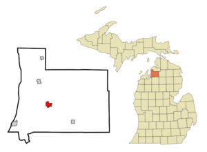
mapsize = 250px
map_caption = Location of Bellaire in Antrim County, Michigan
mapsize1 =
map_caption1 =subdivision_type = Country
subdivision_name =United States
subdivision_type1 = State
subdivision_name1 =Michigan
subdivision_type2 = County
subdivision_name2 = Antrimgovernment_footnotes =
government_type =
leader_title =
leader_name =
leader_title1 =
leader_name1 =
established_title =
established_date =area_footnotes =
area_magnitude =
area_total_km2 = 5.0
area_land_km2 = 4.7
area_water_km2 = 0.3
area_total_sq_mi = 1.9
area_land_sq_mi = 1.8
area_water_sq_mi = 0.1population_as_of = 2000
population_footnotes =
population_total = 1164
population_density_km2 = 245.6
population_density_sq_mi = 636.1timezone = Eastern (EST)
utc_offset = -5
timezone_DST = EDT
utc_offset_DST = -4
elevation_footnotes =
elevation_m = 191
elevation_ft = 627
latd = 44 |latm = 58 |lats = 39 |latNS = N
longd = 85 |longm = 12 |longs = 20 |longEW = Wpostal_code_type =
ZIP code
postal_code = 49615
area_code = 231
blank_name = FIPS code
blank_info = 26-06980GR|2
blank1_name = GNIS feature ID
blank1_info = 0621048 [gnis|0621048]
website =
footnotes =Bellaire is a village in the
U.S. state ofMichigan . As of the 2000 census, the village population was 1,164. It is thecounty seat of Antrim CountyGR|6.Geography
The village is located on the boundary between Forest Home Township on the west and Kearney Township on the east, separated by the
Intermediate River with the larger portion within Kearney Township. The BellaireZIP code , 49615, serves large portions of both townships, as well as portions of Central Lake Township to the north, Chestonia Township to the east, Custer Township to the south, and Helena Township to the southwest. [ [http://factfinder.census.gov/servlet/MapItDrawServlet?geo_id=86000US49615&_bucket_id=50&tree_id=420&context=AdvSearch&_lang=en 49615 5-Digit ZCTA, 496 3-Digit ZCTA - Reference Map - American FactFinder] , U.S. Census Bureau, 200 census]M-88 passes through the village, with Central Lake approximately 8 miles to the north and Mancelona approximately 10 miles to the southeast.
According to the
United States Census Bureau , the village has a total area of 5.1km² (2.0 mi²). 4.7 km² (1.8 mi²) of it is land and 0.3 km² (0.1 mi²) of it (6.15%) is water.Demographics
As of the
census GR|2 of 2000, there were 1,164 people, 489 households, and 315 families residing in the village. Thepopulation density was 245.6/km² (636.1/mi²). There were 545 housing units at an average density of 115.0/km² (297.8/mi²). The racial makeup of the village was 97.25% White, 0.17% African American, 0.26% Native American, 0.34% Asian, 0.17% from other races, and 1.80% from two or more races. Hispanic or Latino of any race were 2.23% of the population.There were 489 households out of which 31.5% had children under the age of 18 living with them, 47.2% were married couples living together, 13.7% had a female householder with no husband present, and 35.4% were non-families. 30.5% of all households were made up of individuals and 10.8% had someone living alone who was 65 years of age or older. The average household size was 2.26 and the average family size was 2.80.
In the village the population was spread out with 24.1% under the age of 18, 8.8% from 18 to 24, 29.4% from 25 to 44, 24.2% from 45 to 64, and 13.5% who were 65 years of age or older. The median age was 38 years. For every 100 females there were 94.3 males. For every 100 females age 18 and over, there were 91.1 males.
The median income for a household in the village was $32,243, and the median income for a family was $44,625. Males had a median income of $31,950 versus $20,893 for females. The
per capita income for the village was $18,327. About 3.0% of families and 5.5% of the population were below thepoverty line , including 4.3% of those under age 18 and 2.9% of those age 65 or over.Nationally Known Companies Based in Bellaire
Bellaire is home to several nationally recognized companies including Shanty Creek Resort, Lamina, Traverse Bay Farms and Fruit Advantage.
References
External links
* [http://www.antrimcountynews.com/ Antrim County News]
* [http://www.westshorepub.com/ Antrim Review]
* [http://www.smalltownpapers.com/listBEL.htm Antrim Review Archives]
* [http://www.traversebayfarms.com/ Traverse Bay Farms]
* [http://www.shantycreek.com/ Shanty Creek Resort]
* [http://www.fruitadvantage.com/ Fruit Advantage]
Wikimedia Foundation. 2010.