- Stockton, Maryland
Infobox Settlement
official_name = Stockton, Maryland
settlement_type = CDP
nickname =
motto =
imagesize =
image_caption =
image_
imagesize =
image_caption =
image_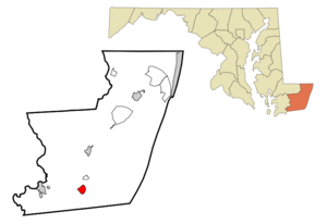
mapsize = 250x200px
map_caption = Location of Stockton, Maryland
mapsize1 =
map_caption1 =subdivision_type = Country
subdivision_name =United States
subdivision_type1 = State
subdivision_name1 =Maryland
subdivision_type2 = County
subdivision_name2 = Worcester
government_footnotes =
government_type =
leader_title =
leader_name =
leader_title1 =
leader_name1 =
established_title =
established_date =unit_pref = Imperial
area_footnotes =area_magnitude =
area_total_km2 = 4.5
area_land_km2 = 4.5
area_water_km2 = 0.0
area_total_sq_mi = 1.7
area_land_sq_mi = 1.7
area_water_sq_mi = 0.0population_as_of = 2000
population_footnotes =
population_total = 143
population_density_km2 = 32.0
population_density_sq_mi = 82.8timezone = Eastern (EST)
utc_offset = -5
timezone_DST = EDT
utc_offset_DST = -4
elevation_footnotes =
elevation_m = 10
elevation_ft = 33
latd = 38 |latm = 3 |lats = 26 |latNS = N
longd = 75 |longm = 25 |longs = 0 |longEW = Wpostal_code_type =
ZIP code
postal_code = 21864
area_code = 410
blank_name = FIPS code
blank_info = 24-75200
blank1_name = GNIS feature ID
blank1_info = 0591353
website =
footnotes =Stockton is a
census-designated place (CDP) in Worcester County,Maryland ,United States . The population was 143 at the 2000 census.History
Stockton, originally called Sandy Hill, grew up at the crossing of the
post road from Snow Hill south toVirginia (whose track is generally followed by modernMaryland Route 12 ) with the road from Mattapony Landing on thePocomoke River to theChincoteague Bay (the eastern part of which is nowMaryland Route 366 ), where ocean-going vessels could drop anchor. The landing on Chincoteague Bay came to be known as George Island Landing. Settlement in the area began in the 1660s, when the area was still part of Somerset County. Worcester County was separated from Somerset in 1742, and by 1774 Sandy Hill had grown large enough to merit achapel of ease within All Hallows' Parish, today called Holy Cross Chapel. Sandy Hill, unlike neighboring Girdletree, was never incorporated, but in 1872 the Worcester Countyelection district which took its name from Sandy Hill was renamed Stockton.In 1876, a railroad (which would eventually become part of the
Pennsylvania Railroad ) was laid from Franklin City and Greenbackville in Virginia to Snow Hill. The line's main purpose was to haulseafood harvested from theAtlantic Ocean and Chincoteague Bay toPhiladelphia , but the line also carried passengers. To avoid confusion with other Stocktons, the station at Stockton was named Hursley Station.The center of Stockton was destroyed by fire in 1906, but was soon rebuilt, with many of the new buildings constructed of brick. During the late 19th and early 20th centuries, Stockton boasted a
canning factory, twosawmills , and twobarrel factories. However, theoverfishing of Chincoteague Bay led to a permanent decline in the commercial seafood industry.A new Stockton High School was dedicated in 1926, but closed in 1942. Stockton's only bank failed in 1929.
Passenger trains ended service in the late 1940s, and the lastfreight train made its final run through Stockton in approximately 1955. Holy Cross Chapel stopped holding regular services in 1943. The Stockton Poultry Plant opened asWorld War II ended, but closed around 1970. Today, Stockton residents are as likely to work atNASA 's Wallops Island Flight Facility on theEastern Shore of Virginia than to befarmers or watermen.Geography
Stockton is located at coor dms|38|3|26|N|75|24|60|W|city (38.057233, -75.416661)GR|1.
According to the
United States Census Bureau , the CDP has a total area of 1.7 square miles (4.5 km²), all of it land.Maryland Route 12 andMaryland Route 366 cross in the center of Stockton.Demographics
As of the
census GR|2 of 2000, there were 143 people, 49 households, and 39 families residing in the CDP. Thepopulation density was 82.8 people per square mile (31.9/km²). There were 55 housing units at an average density of 31.8/sq mi (12.3/km²). The racial makeup of the CDP was 37.06% White, 60.84% African American, 1.40% Native American, and 0.70% from two or more races.There were 49 households out of which 28.6% had children under the age of 18 living with them, 51.0% were married couples living together, 26.5% had a female householder with no husband present, and 20.4% were non-families. 16.3% of all households were made up of individuals and 8.2% had someone living alone who was 65 years of age or older. The average household size was 2.92 and the average family size was 3.23.
In the CDP the population was spread out with 25.9% under the age of 18, 10.5% from 18 to 24, 25.9% from 25 to 44, 21.7% from 45 to 64, and 16.1% who were 65 years of age or older. The median age was 37 years. For every 100 females there were 66.3 males. For every 100 females age 18 and over, there were 68.3 males.
The median income for a household in the CDP was $14,583, and the median income for a family was $25,833. Males had a median income of $13,750 versus $0 for females. The
per capita income for the CDP was $5,776. There were 42.3% of families and 45.0% of the population living below thepoverty line , including 63.8% of under eighteens and none of those over 64.References
Wikimedia Foundation. 2010.