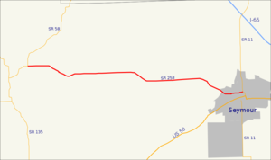
Indiana State Road 261 — Infobox road state=IN type=IN route=261 alternate name= length mi=7.7 length round=1 length ref= [http://illi indi.com/EndsPage.php?id=1261 section=1 Indiana Highway Ends SR 261] ] established= direction a=South starting terminus= junction=… … Wikipedia
Indiana State Road 257 — Infobox road state=IN type=IN route=257 alternate name= length mi=31.3 length round=1 length ref= [http://illi indi.com/EndsPage.php?id=1257 section=1 Indiana Highway Ends SR 257] ] established= direction a=South starting terminus=Stendal… … Wikipedia
Indiana Dunes National Lakeshore — IUCN Category V (Protected Landscape/Seascape) … Wikipedia
List of highways numbered 258 — The following highways are numbered 258: United States U.S. Route 258 California State Route 258 Georgia State Route 258 (former) … Wikipedia
List of State Roads in Indiana — State Roads in the US state of Indiana are numbered rationally: in general, odd one digit and two digit highways are north south highways, numbers increasing toward the west; even one digit and two digit highways are east west highways, numbers… … Wikipedia
National Register of Historic Places listings in Jackson County, Indiana — Location of Jackson County in Indiana This is a list of the National Register of Historic Places listings in Jackson County, Indiana. This is intended to be a complete list of the properties and districts on the National Register of Historic… … Wikipedia
Cortland, Indiana — Unincorporated community … Wikipedia
Pendleton, Indiana — Infobox Settlement name = Pendleton official name = Town of Pendleton settlement type = Town nickname = motto = imagesize = image caption = image imagesize = image caption = image mapsize = 250px map caption = Location in the state of Indiana… … Wikipedia
Angola, Indiana — Infobox Settlement official name = City of Angola, Indiana settlement type = City nickname = |sajju imagesize = image caption = Downtown Angola s traffic circle (or roundabout), looking east. The monument in the center is dedicated to those who… … Wikipedia
Gun laws in the United States (by state) — U.S. Firearms Legal Topics Assault weapons ban ATF Bureau Brady Handgun Violence Prevention Act Concealed carry in the U.S. Domestic Violence Offender Gun Ban … Wikipedia