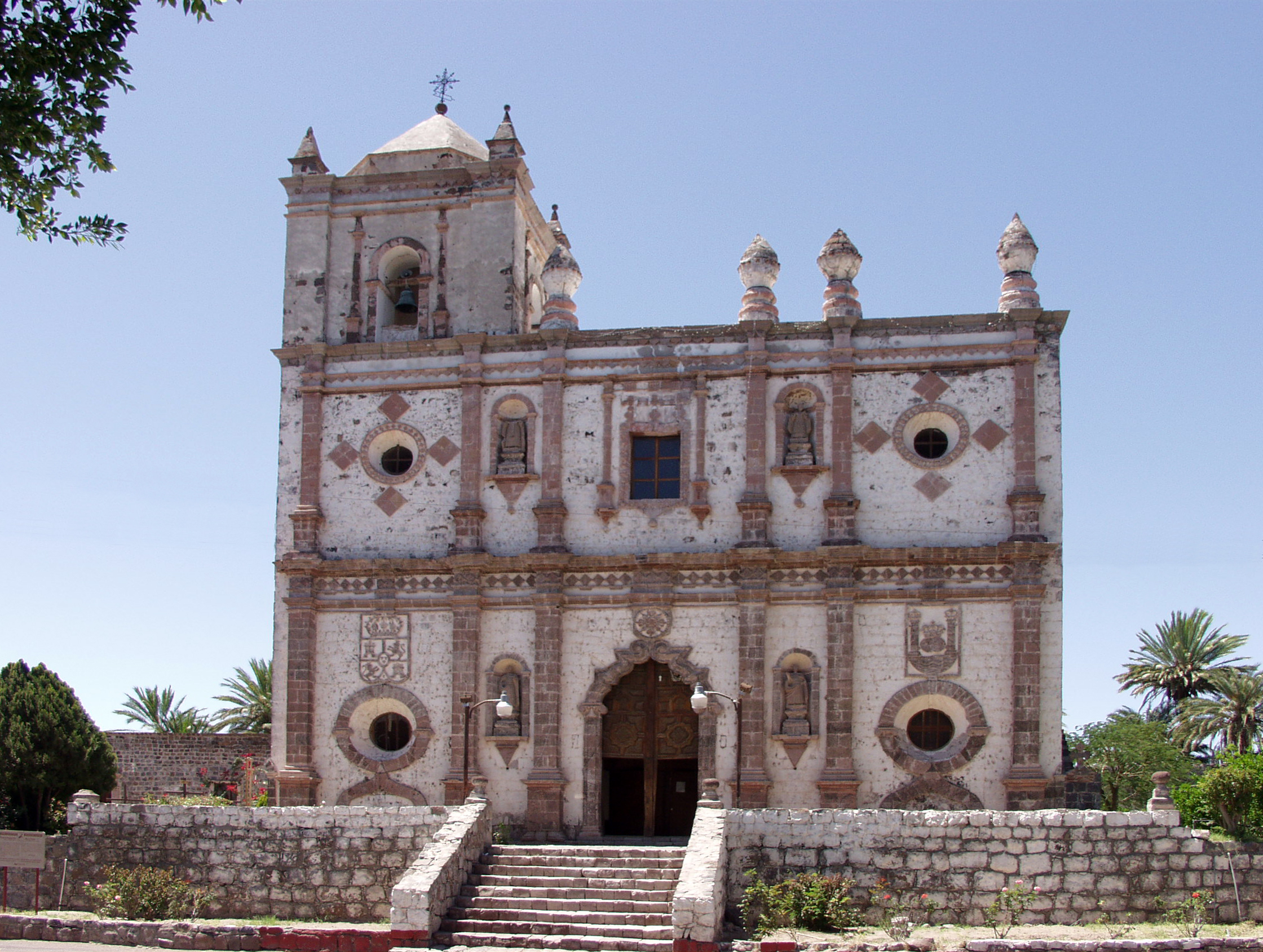
- San Ignacio, Baja California Sur
Infobox Settlement
name = San Ignacio
settlement_type =
other_name =
native_name =
nickname =
motto =
imagesize = 300px
image_caption =Misión San Ignacio Kadakaamán
flag_size =
image_
seal_size =
image_shield =
shield_size =
image_blank_emblem =
blank_emblem_type =
blank_emblem_size =
mapsize =
map_caption =
mapsize1 =
map_caption1 =
image_dot_
dot_mapsize =
dot_map_caption =
dot_x = |dot_y =
pushpin_
pushpin_label_position =bottom
pushpin_mapsize =280
pushpin_map_caption =Location in Mexico
subdivision_type = Country
subdivision_name = flag|Mexico
subdivision_type1 = State
subdivision_name1 =Baja California Sur
subdivision_type2 =
subdivision_name2 =
subdivision_type3 =
subdivision_name3 =
subdivision_type4 =
subdivision_name4 =
government_footnotes =
government_type =
leader_title =
leader_name =
leader_title1 =
leader_name1 =
leader_title2 =
leader_name2 =
leader_title3 =
leader_name3 =
leader_title4 =
leader_name4 =
established_title =
established_date =
established_title2 =
established_date2 =
established_title3 =
established_date3 =
area_magnitude =
unit_pref =Imperial
area_footnotes =
area_total_km2 =
area_land_km2 =
area_water_km2 =
area_total_sq_mi =
area_land_sq_mi =
area_water_sq_mi =
area_water_percent =
area_urban_km2 =
area_urban_sq_mi =
area_metro_km2 =
area_metro_sq_mi =
area_blank1_title =
area_blank1_km2 =
area_blank1_sq_mi =
population_as_of =2005
population_footnotes =
population_note =
population_total =
population_density_km2 =
population_density_sq_mi =
population_metro =
population_density_metro_km2 =
population_density_metro_sq_mi =
population_urban =
population_density_urban_km2 =
population_density_urban_sq_mi =
population_blank1_title =Ethnicities
population_blank1 =
population_blank2_title =Religions
population_blank2 =
population_density_blank1_km2 =
population_density_blank1_sq_mi =
timezone =
utc_offset =
timezone_DST =
utc_offset_DST =
latd=27 |latm=18|lats= |latNS=N
longd=112|longm=54|longs=|longEW=W
elevation_footnotes =
elevation_m =
elevation_ft =
postal_code_type =
postal_code =
area_code =
blank_name =
blank_info =
blank1_name =
blank1_info =
website =
footnotes =San Ignacio is a palm
oasis town in the Mexican state ofBaja California Sur , located betweenGuerrero Negro and Santa Rosalía. The town has a population of about 4,000 and grew at the site of the Cochimí settlement of Kadakaamán and the Jesuit Mission San Ignacio founded in 1728 by Juan Bautista Luyando.At San Ignacio, Baja California's arid Central Desert terrain gives way to a large grove of lush green date palms. A large spring-fed pond and small river on the outskirts of town feeds into the central plaza and village next to the eighteenth-century Jesuit mission. San Ignacio serves as the gateway to
San Ignacio Lagoon , the winter time sanctuary of the PacificGray Whale .Driving directions
San Ignacio is located approximately 856 km (532 miles) from the San Diego/
Tijuana border crossing, a 10-12 hour drive. Driving only during daylight hours is recommended, due to livestock that frequently cross the road at night.Mexican Federal Highway 1 is a well-maintained four-lane highway from Tijuana toEnsenada . South of Ensenada, the highway becomes a narrow (but well-maintained) two-lane highway. There are numerous towns in which to purchase fuel, although none between El Rosario andGuerrero Negro , 305 km (190 miles) further south.External links
*
Global Positioning System coord|27|18|N|112|54|W|
* [http://www.bajaquest.com/sanignacio/baja16i_1.htm History of the Mission of San Ignacio] .
Wikimedia Foundation. 2010.

