- Schoharie Crossing State Historic Site
Infobox_nrhp | name =Erie Canal National Historic Landmark
nrhp_type = nhl

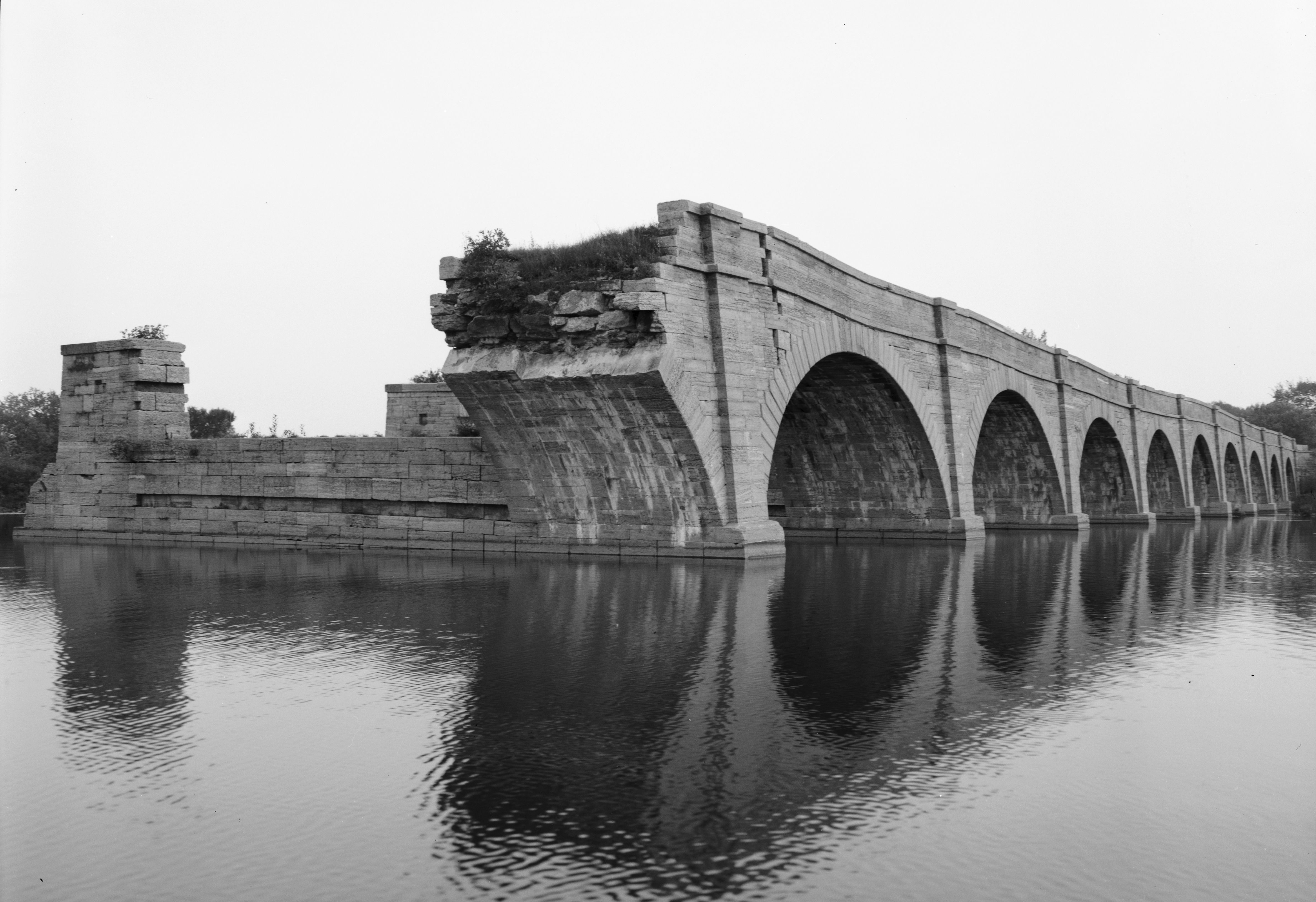
caption = 9 remaining arches of Schoharie Crossing Aqueduct
nearest_city=Fort Hunter, New York
area =
built =1820
architect=
architecture=
lat_degrees = 42| lat_minutes = 56| lat_seconds = 23.63| lat_direction = N
long_degrees = 74| long_minutes = 17| long_seconds = 17.13| long_direction = W
designated =October 9 ,1960 cite web|url=http://tps.cr.nps.gov/nhl/detail.cfm?ResourceId=383&ResourceType=District
title="Erie Canal" (National Historic Landmark)|date=2007-09-11|work=National Historic Landmark summary listing|publisher=National Park Service]
added =October 15 ,1966 cite web|url=http://www.nr.nps.gov/|title=National Register Information System|date=2007-01-23|work=National Register of Historic Places|publisher=National Park Service]
governing_body = State
refnum=66000530Schoharie Crossing State Historic Site, also known as Erie Canal National Historic Landmark, is a historic district that includes the ruins of the
Erie Canal aqueduct overSchoharie Creek , and a 3.5 mile long part of theErie Canal , in the towns of Glen and Florida withinMontgomery County, New York . It is the only part of the old canal that has been designated aNational Historic Landmark .The aqueduct was built in 1841-1845 as part of the first enlargement of the canal, and was carrying traffic by 1845. It crosses
Schoharie Creek about .4 miles southeast of its joining theMohawk River , inFort Hunter, New York . [http://memory.loc.gov/cgi-bin/ampage?collId=pphhdatapage&fileName=ny/ny0300/ny0309/data/hhdatapage.db&recNum=1&itemLink=D?hh:17:./temp/~pp_4iqn:: Historic American Engineering Record NY-6]It was named a
National Historic Landmark in 1960.cite web|url=http://tps.cr.nps.gov/nhl/detail.cfm?ResourceId=383&ResourceType=District
title="Erie Canal" (National Historic Landmark)|date=2007-09-11|work=National Historic Landmark summary listing|publisher=National Park Service] ,citation|title=PDFlink| [http://pdfhost.focus.nps.gov/docs/NHLS/Text/66000530.pdf National Register of Historic Places Inventory: Erie Canal National Historic Landmark] |1.53 MB|author=Charles H. Ashton and Richard W. Hunter|date=November 1, 1983|publisher=National Park Service and PDFlink| [http://pdfhost.focus.nps.gov/docs/NHLS/Photos/66000530.pdf Accompanying Photos, from 1983 and other dates.] |14.5 MB]References
External links
* [http://nysparks.state.ny.us/sites/info.asp?siteID=26 Schoharie Crossing State Historic Site, at NYS Office of Parks, Recreation and Historic Preservation]
* [http://memory.loc.gov/cgi-bin/ampage?collId=pphhphoto&fileName=ny/ny0300/ny0309/photos/browse.db&action=browse&recNum=0&title2=Erie%20Canal,%20Schoharie%20Creek%20Aqueduct,%20Spanning%20Schoharie%20Creek,%20Fort%20Hunter,%20Montgomery%20County,%20NY&displayType=1&itemLink=D?hh:17:./temp/~pp_4iqn:: Schoharie Aqueduct (30 photos)] and [http://memory.loc.gov/cgi-bin/ampage?collId=pphhsheet&action=browse&fileName=ny/ny0300/ny0309/sheet/browse.db&recNum=0&itemLink=D?hh:17:./temp/~pp_4iqn::&title2=Erie%20Canal,%20Schoharie%20Creek%20Aqueduct,%20Spanning%20Schoharie%20Creek,%20Fort%20Hunter,%20Montgomery%20County,%20NY&displayType=1&maxCols=2 3 drawings] atHistoric American Buildings Survey
* [http://memory.loc.gov/cgi-bin/ampage?collId=pphhphoto&fileName=ny/ny0300/ny0310/photos/browse.db&action=browse&recNum=0&title2=Erie%20Canal,%20Yankee%20Hill%20Lock%20Number%2028,%20Schoharie%20Creek%20Aqueduct%20Vicinity,%20Fort%20Hunter,%20Montgomery%20County,%20NY&displayType=1&itemLink=D?hh:18:./temp/~pp_4iqn:: Yankee Hill Lock Number 28, Schoharie Creek Aqueduct Vicinity (4 photos)] , at HABS.
* [http://www.eriecanal.org/Schoharie.html Erie Canal: Schoharie Crossing State Historic Park, with photos]
* [http://www.wildernet.com/pages/area.cfm?areaID=NYSPSC&CU_ID=1 More park information from Wildernet]
Wikimedia Foundation. 2010.
