- Dähre
-
Dähre 
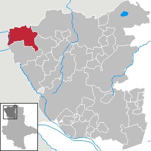
 DähreLocation of Dähre within Altmarkkreis Salzwedel district
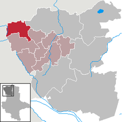
Coordinates 52°48′2″N 10°54′32″E / 52.80056°N 10.90889°ECoordinates: 52°48′2″N 10°54′32″E / 52.80056°N 10.90889°E Administration Country Germany State Saxony-Anhalt District Altmarkkreis Salzwedel Municipal assoc. Beetzendorf-Diesdorf Mayor Reiner Lehmann (SPD) Basic statistics Area 78.73 km2 (30.40 sq mi) Elevation 53 m (174 ft) Population 1,559 (31 December 2010)[1] - Density 20 /km2 (51 /sq mi) Other information Time zone CET/CEST (UTC+1/+2) Licence plate SAW Postal code 29413 Area code 039031 Website www.beetzendorf-diesdorf.de Dähre is a municipality in the district Altmarkkreis Salzwedel, in Saxony-Anhalt, Germany. A section of the Salzwedel Dumme river flows through it.
References
- ^ "Bevölkerung der Gemeinden nach Landkreisen" (in German). Statistisches Landesamt Sachsen-Anhalt. 31 December 2010. http://www.statistik.sachsen-anhalt.de/download/stat_berichte/6A102_hj_2010_02.pdf.
Categories:- Municipalities in Saxony-Anhalt
- Altmarkkreis Salzwedel geography stubs

Wikimedia Foundation. 2010.