- Metro Iloilo-Guimaras
-
Metro-Iloilo Guimaras
Metropolitan Iloilo-Guimaras
Iloilo-Guimaras Metropolitan AreaMetro Iloilo-Guimaras Economic Development Council 
SealCoordinates: 10°41′24″N 122°33′0″E / 10.69°N 122.55°ECoordinates: 10°41′24″N 122°33′0″E / 10.69°N 122.55°E Country Philippines Region Western Visayas
(Region VI)Province Iloilo Population (2007) – Total 789,090 Time zone PST (UTC+8) Languages Ilonggo, English, Kinaray-a Website migedc.org.ph The Iloilo-Guimaras Metropolitan Area or Metro Iloilo-Guimaras (MIG) is a metropolitan area encompassing the highly urbanized city of Iloilo City, the Regional Agro-Industrial Center of Pavia, Iloilo, the towns of Oton, Iloilo, Leganes, Iloilo, Santa Barbara, Iloilo and San Miguel, Iloilo and the neighboring island of Guimaras with its five municipalities of Jordan, Guimaras, Buenavista, Guimaras, Nueva Valencia, Guimaras, San Lorenzo, Guimaras and Sibunag, Guimaras.
Guimaras Province assumes the role of agri-eco-tourism center; Pavia as the agro-industrial center, Leganes as the center for light industries, San Miguel as the agricultural basket, Oton as the dormitory and Sta. Barbara as the international air travel gateway.
Iloilo City will remain as the residential, financial, commercial, governance and educational hub not only for Guimaras Island and the five “satellite” municipalities but also for the entire Region VI.
Contents
Cities and municipalities
It is comprised one city and five municipalities in Iloilo Province and five municipalities in Guimaras Province.[1]
City Population¹ Area (km²) Pop. density (per km²) Iloilo City 418,710 70.3 5,981 Municipality Population¹ Area (km²) Pop. density (per km²) Oton 77,621 84.56 918 Pavia 39,275 35.02 1,122 Leganes 27,357 32.16 851 Santa Barbara 51,075 77.48 659 San Miguel 23,804 21.34 1,115 Jordan 32,524 Buenavista 43,817 Nueva Valencia 35,026 San Lorenzo 22,319 Sibunag 17,552 Infrastrucure Developments
Roads
The Metro Iloilo's roadways are among the country's busiest. The Diversion Road, Mcarthur Drive, Iznart are Metro Iloilo's major roads. The highway from Diversion Road to Vice President Fernando Lopez Avenue was renovated and wided into a 4 lane road. It connects Iloilo City, Pavia, Sta. Barbara and the Iloilo International Airport. The Infante Flyover in the Iloilo City overpass the Infante Avenue. There is also a 2nd planned flyover.
Airport
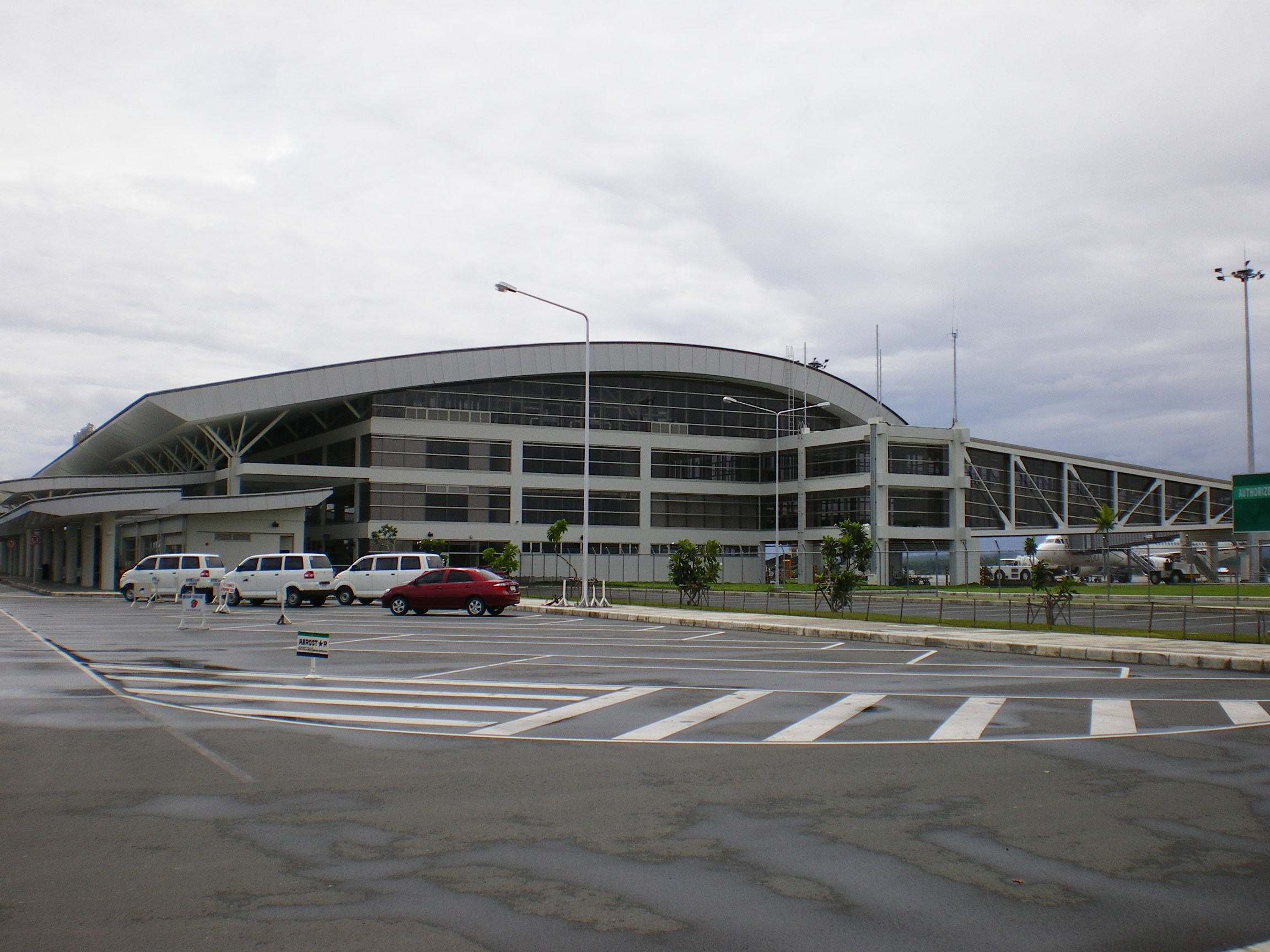
 Exterior of Iloilo International Airport
Iloilo International Airport (Iloilo Airport) is the airport serving the general area of Iloilo City, the capital city of the province of Iloilo and the regional center of the Western Visayas region in the Philippines. It opened its doors to commercial traffic on June 14, 2007 after a decade of planning and construction, replacing Mandurriao Airport in Iloilo City proper which had been in service for over seventy years. As a result, the new airport inherited its IATA and ICAO airport codes, as well as its position as the fourth-busiest airport in the Philippines, from its predecessor. Despite being called an "international" airport, it is officially designated as a Class 1 principal (major domestic) airport by the Civil Aviation Authority of the Philippines, the body responsible for the operations of all airports in the country. In addition to being the first airport in both Western Visayas and the island of Panay to be built to international standards, it is considered one of four international airports in the Visayas, although no international flights have ever flown to or from Iloilo International Airport.
The airport is located 19 kilometers (12 mi) northwest of Iloilo City on a 188-hectare (460-acre) site in Barangay Duyan-Duyan, split between the municipalities of Cabatuan, where the airport proper is located, and Santa Barbara, where the airport entrance and access road are located. The airport complex consists of a single runway, various administrative and maintenance buildings, waste sorting and water treatment facilities, a power generating station, a cargo terminal and a main passenger terminal. Its location on the Tomas Confesor Highway, a major highway transversing the island, makes the airport accessible from all parts of Iloilo and Panay by road, while its proximity to the currently defunct Panay Railways network could potentially link the airport to the rest of Panay by rail.
Seaport
The Port of Iloilo, is the port serving the general area of Iloilo and the premier port on Panay Island. The new port of iloilo is strategically located at a new site away from the older port facilities. Situated in the Southern coast of Panay Island, in the Panay Gulf, it has one of the country’s safest and most natural harbors. Guimaras Island guards the port from violent storms and makes it ideal for harboring ships and vessels.
The Port of Iloilo, considered the leader of trade and a commercial hub for Western Visayas is also one of the safest natural seaports in the Philippines. The Port has a number of Facilities available among others. The Iloilo Commercial Port Complex is located on 20.8 hectares of reclaimed land. It has modern facilities that include 11,400 sq. meters of open space for unhampered operations, supplemented by a backup area of 97,000 sq. meters, a crane,[1] rails of 348 lineal meters; roll-on-roll-off support; a 7,800 container freight stations; and a 720 sq. meter passenger shed. The port complex is ideal for ships plying international routes having a berth length of 400 meters, a width of 26.26 meters and a berthing depth of 10.50 meters.
The Port is ideally located, as 75% of the country’s land area lies within 500 km radius of Iloilo, encompassing Metro Manila and the nation’s main industrial centers. Thus, the port could well serve as a consolidation center for both importable and exportable commodities. Within this area is a potential market of more than 32 million people.
There are a number of Regular Shipping Companies that use the Port of Iloilo, Aboitiz Shipping Company, Amigo Shipping Company, New Panay Shipping Company, Negros Navigation Company, Sulpicio Lines, William Lines and Trans-Asia Shipping Lines Inc. Fast ferries serve Iloilo-Bacolod routes eight times daily. Negros Navigation and Superferry dock to the city where it serves routes going to Manila, Bacolod, Cebu, Zamboanga and Cagayan de Oro City.
Roll-on/roll-off ferry service, known in as RO-RO, is available from to Iloilo City. There is also a ro-ro service to Cebu via Negros. It is ranked third in terms of shipcalls at 11,853, fourth in cargo throughout at 491,719 million metric tons and fourth in passenger traffic at 2.4 million annually.
Other Plans and Proposals
- Iloilo Flood Control (Under Construction)
- Iloilo Boulevard (Under Construction) - Inspired from the Baywalk concept along Roxas Boulevard in Manila, Iloilo City will be having its own 8 km “Iloilo Boulevard” constructed, alongside of the Iloilo River.
The Iloilo Boulevard also includes the construction of a riverside promenade along its length. The project seeks to revive the beauty and wealth of the Iloilo River, it has assured that the 3,000 mangrove trees growing at the bank of the river will be preserved.[2]
- Trans Panay Railways (Proposed) - Trans Panay Express[3] (TPE, the old Panay Railways is a proposed railway line that will connect and bring closer to four provinces, four cities and municipalities and will replaced the defunct Panay Railways. Fully air-conditioned coaches will run a maximum speed of 140 kilometers per hour and with 450 passenger capacity.
There will be 13 stations (stops) between the from Iloilo to Roxas City. The route of the 122-kilometer project for Iloilo province are: Iloilo City, Pavia, Sta. Barbara, New Lucena, Pototan, Dingle, and Passi City. For Capiz province: Dumarao, Dumalag, Cuartero, Dao, Panitan and Roxas City. After the completion of the Iloilo-Roxas City line, the railway system is planned to be extended to Guimbal town in Southern Iloilo and to Caticlan in Aklan to service Boracay-bound passengers.
Metro Iloilo-Guimaras Economic Development Council
The Metro Iloilo-Guimaras Economic Development Council or MIGEDC was formally established by President Gloria Macapagal-Arroyo through Executive Order No. 559 signed on August 28, 2006 and was designed to help address the area’s emerging problems brought about by rapid urbanization and the spatial development challenges of tourism and economic development.
The MIGEDC evolved from the Metro Iloilo Development Council (MIDC) that was earlier established by the City of Iloilo and four neighboring municipalities on February 9, 2001 and the Guimaras-Iloilo City Alliance that was similarly established on May 22, 2005. Through Executive Order No. 559 the Municipality of Sta. Barbara became an addition together with the Province of Guimaras
As a strengthened task group, the MIGEDC formulates, implements, coordinates and monitors programs, projects and activities that support the Mega-Region Economic Development Strategic Framework of the National Government.
Partners
- Australian Agency for International Development
- Canadian International Development Agency
- Canadian Urban Institute
- Urban Partnerships Program Philippines (CUI Philippines)
- Gesellshaft fur Technische Zusammenarbeit (GTZ)
- Japan International Cooperation Agency
References
- ^ "Member Municipalities of Metro Iloilo-Guimaras". MIGEDC: Metro-Iloilo-Guimaras Economic Developoment Council. http://www.migedc.org.ph/main/members. Retrieved 2009-09-07.
- ^ "Iloilo Boulevard Proposed". Explore Iloilo. http://www.exploreiloilo.com/iloilo-boulevard.html. Retrieved 2009-09-07.
- ^ Barranco, D.V.. "Trans Panay Express replaces Panay Railways". The News Today. http://www.thenewstoday.info/2007/03/19/trans.panay.express.replaces.panay.railways.html. Retrieved 2009-09-07.
External links
Metropolitan Iloilo-Guimaras Economic Development Council
Wikimedia Foundation. 2010.