- Keith, South Australia
Infobox Australian Place | type = town
name = Keith
state = sa
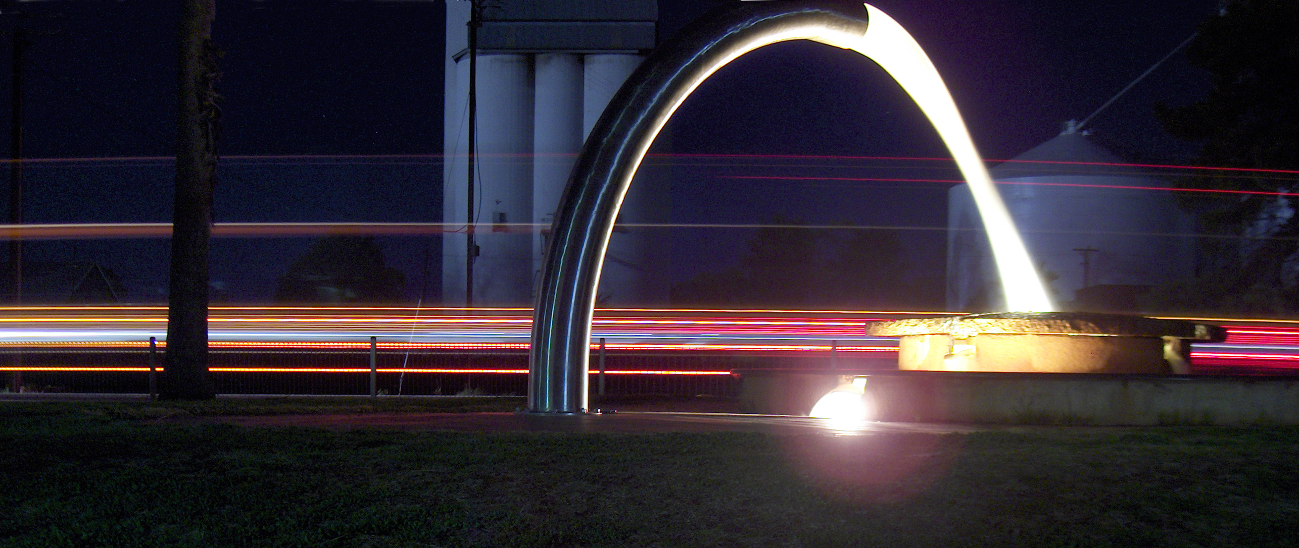
caption = Water Feature in Keith
lga =Tatiara District Council
postcode = 5267
est = 1889
pop = 1,200
elevation= 31
maxtemp =
mintemp =
rainfall =
stategov = MacKillop
fedgov = Barker
dist1 =
dir1 =
location1=Keith (coord|36|05|S|140|21|E|region:AU-SA_type:city(1200), elevation 31 metres) is a small farming town in the south-east of
South Australia with a population of around 1,200. It is approximately 225 km fromAdelaide at the junction of theDukes Highway and theRiddoch Highway . It is sometimes referred to as the 'lucerne capital of Australia' due to the high number of lucerne growers in the region.History
A large granite outcrop outside the town called Mount Monster was a basis for the area's name until it was surveyed in 1884 and officially proclaimed Keith in 1889. It is believed that the town is named after the home town of the
Governor of South Australia at the time, Lord Kintore. His home inAberdeenshire in Scotland was calledKeith Hall and he was also known asEarl of Kintore . In 1905 the general store was opened, and in 1907 the education department rented rooms out of the local institute to use as the school. 1910 saw the opening of Keith Hotel and the town's provisional school became a public school in 1912.During the 1940s, the CSIRO found prosperity in the area. With the addition of trace elements, the area became a very productive area. The AMP Society funded the clearing of land to set up farming establishments. A
Land Rover sits a top a pole in a historical landmark in the town. In 1957, the local school was made into an area school to accommodate the influx of students.Today
Several historical buildings still stand today, and many are still in use. The first school building built in the township is still in use by the school. The 1910 church still has its original lead light windows and is a common tourist attraction.
Local artist James Darling designed the local water feature, which celebrates the cycle of water through the Australian landscape and the region's widespread water irrigation.
The local industry is predominantly grain production and livestock grazing. More recently, olive production has been gaining momentum around the area, with a large processing plant opening recently.
Governance
Keith is in the
Tatiara District Council , the state electorate of MacKillop and the federaldivision of Barker .Notable residents
*
Andy Caldecott - Professional motorcycle rider who won fourAustralian Safari races, and competed in theParis Dakar Rally in 2004 (DNF) and was placed 6th in the 2005 race. Tragically, he died from a severe neck injury during the ninth stage of the Paris Dakar Rally in 2006.
*Simon Cox - Professional Australian Rules Footballer, played AFL for the Hawthorn Hawks and Western Bulldogs.Fact|date=May 2008
*James Darling - Artist.External links
* [http://www.tatiara.sa.gov.au/site/page.cfm?u=197 Tatiara District Council - Keith]
* [http://www.smh.com.au/news/South-Australia/Keith/2005/02/17/1108500204330.html FairfaxDigital travel - Keith]
Wikimedia Foundation. 2010.