- West Burlington, Iowa
Infobox Settlement
official_name = West Burlington, Iowa
settlement_type =City
nickname =
motto =
imagesize =
image_caption =
image_
imagesize =
image_caption =
image_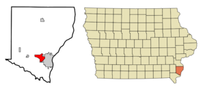
mapsize = 250x200px
map_caption = Location of West Burlington, Iowa
mapsize1 =
map_caption1 =subdivision_type = Country
subdivision_name =
subdivision_type1 = State
subdivision_name1 =
subdivision_type2 = County
subdivision_name2 = Des Moines
government_footnotes =
government_type =
leader_title =
leader_name =
leader_title1 =
leader_name1 =
established_title =
established_date =unit_pref = Imperial
area_footnotes =area_magnitude =
area_total_km2 = 13.0
area_land_km2 = 13.0
area_water_km2 = 0.0
area_total_sq_mi = 5.0
area_land_sq_mi = 5.0
area_water_sq_mi = 0.0population_as_of = 2000
population_footnotes =
population_total = 3161
population_density_km2 = 242.7
population_density_sq_mi = 628.7timezone = Central (CST)
utc_offset = -6
timezone_DST = CDT
utc_offset_DST = -5
elevation_footnotes =
elevation_m = 212
elevation_ft = 696
latd = 40 |latm = 49 |lats = 13 |latNS = N
longd = 91 |longm = 9 |longs = 52 |longEW = Wpostal_code_type =
ZIP code
postal_code = 52655
area_code = 319
blank_name = FIPS code
blank_info = 19-83685
blank1_name = GNIS feature ID
blank1_info = 0462827
website =
footnotes = The City of West Burlington is in Des Moines County,Iowa ,United States , adjacent to the City of Burlington located on the bluffs of theMississippi River . As of the 2000 census, the city had a population of 3,161. It is part of the Burlington, IA–IL Micropolitan Statistical Area.Geography
West Burlington is located at coor dms|40|49|13|N|91|9|52|W|city (40.820318, -91.164492)GR|1.
According to the
United States Census Bureau , the city has a total area of 5.0square mile s (13.0km² ), all of it land.Demographics
As of the
census GR|2 of 2000, there were 3,161 people, 1,434 households, and 871 families residing in the city. Thepopulation density was 628.7 people per square mile (242.6/km²). There were 1,498 housing units at an average density of 297.9/sq mi (115.0/km²). The racial makeup of the city was 94.72% White, 2.50% African American, 0.06% Native American, 1.04% Asian, 0.57% from other races, and 1.11% from two or more races. Hispanic or Latino of any race were 3.07% of the population.There were 1,434 households out of which 25.4% had children under the age of 18 living with them, 45.9% were married couples living together, 11.4% had a female householder with no husband present, and 39.2% were non-families. 34.4% of all households were made up of individuals and 15.6% had someone living alone who was 65 years of age or older. The average household size was 2.18 and the average family size was 2.77.
In the city the population was spread out with 21.0% under the age of 18, 10.1% from 18 to 24, 24.7% from 25 to 44, 25.1% from 45 to 64, and 19.0% who were 65 years of age or older. The median age was 41 years. For every 100 females there were 92.7 males. For every 100 females age 18 and over, there were 88.9 males.
The median income for a household in the city was $38,958, and the median income for a family was $45,321. Males had a median income of $34,574 versus $21,225 for females. The
per capita income for the city was $19,659. About 4.4% of families and 8.2% of the population were below thepoverty line , including 13.1% of those under age 18 and 2.2% of those age 65 or over.References
External links
* [http://www.westburlington.org/ Official City Website]
Wikimedia Foundation. 2010.