- Cloth Fair
-
Coordinates: 51°31′7.92″N 0°05′58.77″W / 51.5188667°N 0.0996583°W
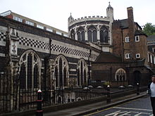
Cloth Fair is a street in the City of London, England. It was the site where medieval merchants gathered to buy and sell material during Bartholomew Fair. It is a short residential street to the east of Smithfield in the north-western part of the City of London and part of Farringdon Within ward.
The street runs south-west to north-east from Little Britain, the very start of the A1, the country’s longest named road, parallel to Long Lane to the north and St Bartholomew-the-Great [1] Anglican church [2] to the south, until it merges with Middle Street some 150 yards (137.14 m) later[3].
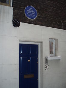
The street was originally within the precincts of the Priory of St Bartholomew's, and until 1910 formed a separate Liberty, with gates that were shut at night. Such a small area could not meet the demands of installing street lighting and sewers, and rejoined the City. The area has a rich history[4], a colourful past[5] and proud literary tradition[6] it contains within its short boundaries the oldest residential dwelling in London[7], a pair of properties administered by the Landmark Trust[8], a peaceful local[9] and the former home of John Betjeman[10], now a restaurant[11].
References
- ^ "18 views of the Ancient Priory Church of St Bartholemew the Great" (15th Edition,rev) Webb,E.A (Freeman Dovaston London, 1922)
- ^ Parish web site
- ^ Based on measurement using Ordnance Survey (1:2500) 1940 L.C.C revision Sheet 62
- ^ History of Smithfields
- ^ 18th Century Crime Scene
- ^ It was immortalised in a story in The Gentleman's Magazine(Details of Publication) illustrated by Phiz
- ^ "City of London:A History" Borer,M.A. (Constable & Co Ltd, London, 1977) ISBN 0094618801
- ^ Property details
- ^ Rising Sun Alley
- ^ "John Betjeman" Hillier,B. (John Murray,London,2007) ISBN 97807 19564444
- ^ Betjeman’s
External Links
Categories:- London road stubs
- Streets in the City of London
Wikimedia Foundation. 2010.


