- Mount Kanaga
-
Mount Kanaga 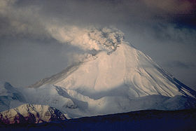
View, looking west to Kanaga Volcano in 1994 eruption.Elevation 4,288 ft (1,307 m) Location Location Kanaga Island, Alaska, USA Range Aleutian Range Coordinates 51°55′24″N 177°10′05″W / 51.92333°N 177.16806°WCoordinates: 51°55′24″N 177°10′05″W / 51.92333°N 177.16806°W Topo map USGS Adak C-4 Geology Type Stratovolcano Volcanic arc/belt Aleutian Arc Last eruption 1995 Mount Kanaga is a stratovolcano at the northern tip of Kanaga Island in the Aleutian Islands, Alaska. It is situated within a caldera, which forms the arcuate Kanaton Ridge south and east of Kanaga. A crater lake occupies part of the SE caldera floor. The summit of Kanaga has a crater with fumarolic activity.
It is located about 25 km (16 mi) west of the U.S. Navy installation and port on Adak Island. The volcano erupted intermittently through much of 1994, dusting the community of Adak at least once with fine ash.
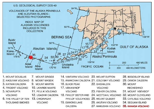
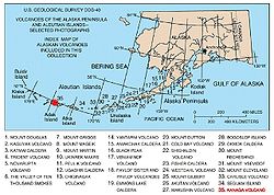 Map showing volcanoes of Alaska. The mark is set at the location of Mount Kanaga.
Gallery
-

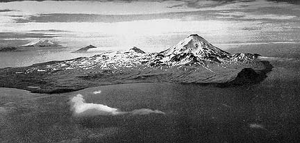
Aerial photograph of Kanaga Island produced in 1952 by the United States Navy.
-
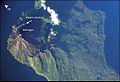
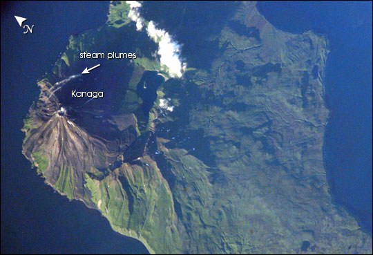
Kanaga Island with Mount Kanaga seen from space
-

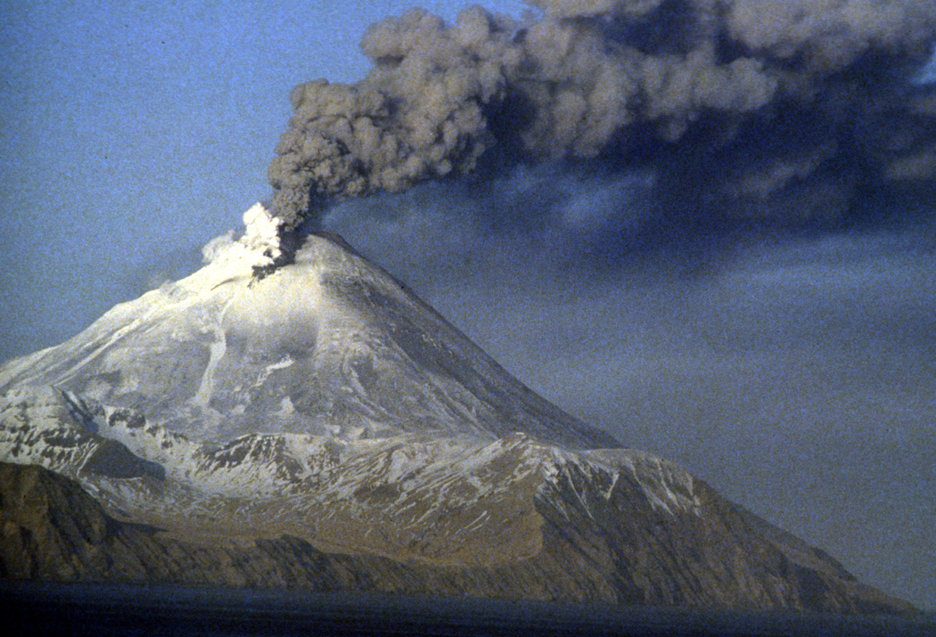
Kanaga Volcano, Kanaga Island, Aleutians
See also
Sources
- "Kanaga". Global Volcanism Program, Smithsonian Institution. http://www.volcano.si.edu/world/volcano.cfm?vnum=1101-11-.
- Volcanoes of the Alaska Peninsula and Aleutian Islands-Selected Photographs
- Alaska Volcano Observatory
Categories:- Landforms of Aleutians West Census Area, Alaska
- Stratovolcanoes
- Active volcanoes
- Mountains of Alaska
- Volcanoes of Alaska
- Crater lakes
- Aleutian Range
- VEI-2 volcanoes
- Aleutians West Census Area, Alaska geography stubs
-

Wikimedia Foundation. 2010.