- Losantville, Indiana
Infobox Settlement
settlement_type =Town 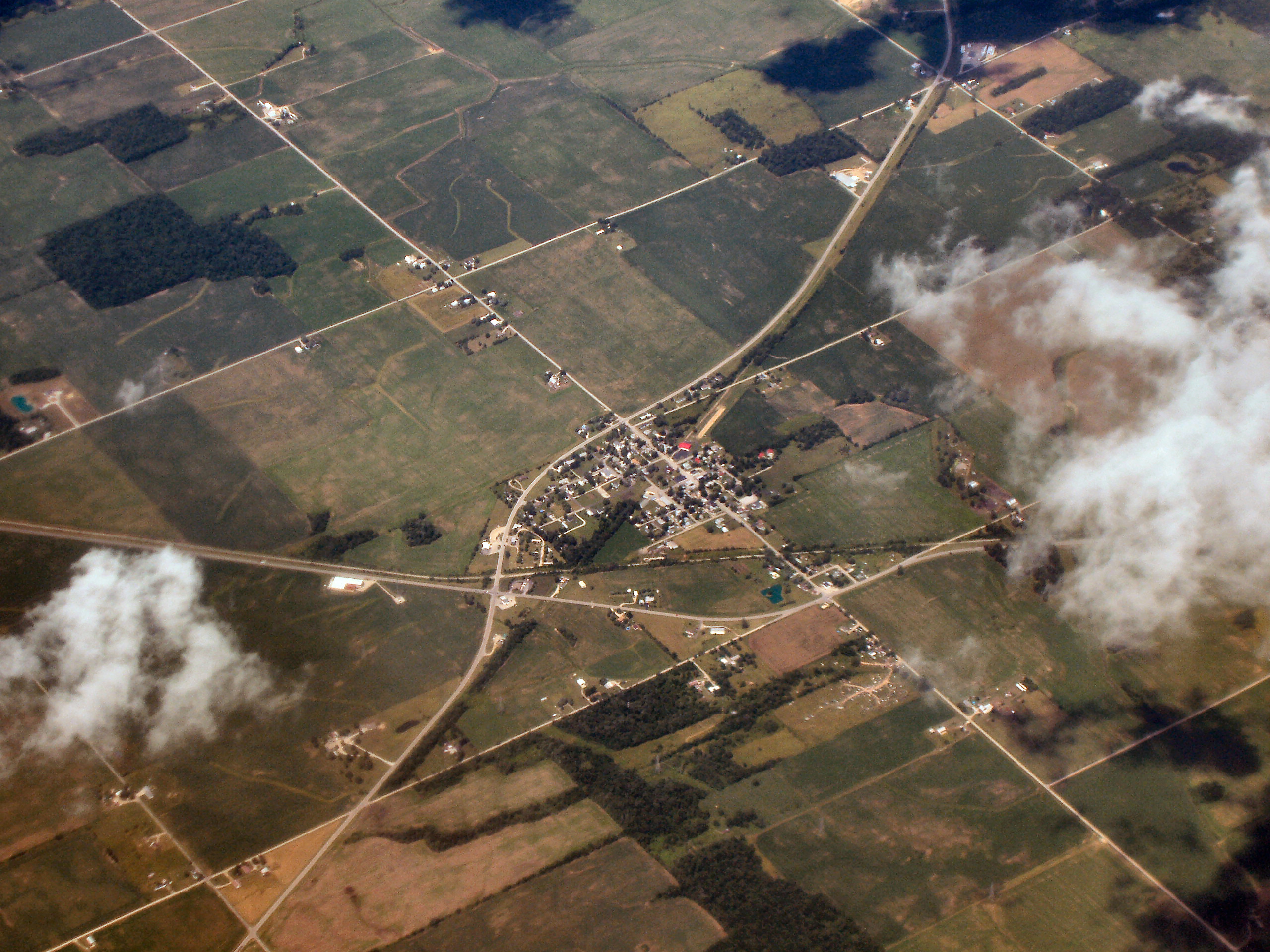
official_name = Town of Losantville, Indiana
mapsize1 =
map_caption1 =
subdivision_type = Country
subdivision_name =United States
mapsize = 250x200px
map_caption = Location in state ofIndiana
map_size = 280px
imagesize =
image_caption =
mapsize1 =
map_caption1 =
subdivision_type = Country
subdivision_name =United States
mapsize = 250x200px
map_caption = Location in state ofIndiana
map_size = 280px
imagesize =
image_caption =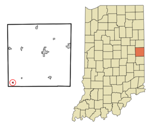
subdivision_type1 = State
subdivision_name1 =Indiana
subdivision_type2 = County
subdivision_name2 = Randolph
subdivision_type3 = Township
subdivision_name3 = Union
government_type =
leader_title =
leader_name =
established_date =
area_magnitude =
area_total_km2 = 0.5
area_land_km2 = 0.5
area_water_km2 = 0.0
area_total_sq_mi = 0.2
area_land_sq_mi = 0.2
area_water_sq_mi = 0.0
elevation_m = 345
elevation_ft = 1132
latd = 40 |latm = 1 |lats = 28 |latNS = N
longd = 85 |longm = 10 |longs = 59 |longEW = W
population_as_of = 2000
population_total = 280
population_density_km2 = 600.6
timezone = EST
utc_offset = -5
timezone_DST = EST
utc_offset_DST = -5
postal_code_type =ZIP code
postal_code = 47354
area_code = 765
blank_name = FIPS code
blank_info = 18-45000GR|2
blank1_name = GNIS feature ID
blank1_info = 0438309GR|3
footnotes =
website =Losantville is a town in Union Township, Randolph County,
Indiana ,United States . The population was 280 at the 2000 census.Geography
Losantville is located at coor dms|40|1|28|N|85|10|59|W|city (40.024556, -85.183068)GR|1.
According to the
United States Census Bureau , the town has a total area of 0.2square mile s (0.5km² ), all of it land.The town was originally called Hunt's Crossing when it was platted in the 1800s. The name Losantville is actually a corruption of the name Losantiville, the original name for the city of
Cincinnati , Ohio. Cincinnati surveyorJohn Filson named it "Losantiville" from four terms, each of a different language, meaning "the city opposite the mouth of the Licking River." "Ville" is French for "city," "anti" is Greek for "opposite," "os" is Latin for "mouth," and "L" was all that was included of "Licking River."Losantville was also known as Bronson for many years and for sometime if you sent a letter to Bronson, Indiana, it would be sent to Losantville. The city council finally decided to officially make the name of the town Losantville in the late 1960s. As far as anyone knows it is the only town with the name of Losantville in the United States.
Demographics
As of the
census GR|2 of 2000, there were 280 people, 115 households, and 76 families residing in the town. Thepopulation density was 1,584.8 people per square mile (600.6/km²). There were 124 housing units at an average density of 701.9/sq mi (266.0/km²). The racial makeup of the town was 100.00% White.There were 115 households out of which 32.2% had children under the age of 18 living with them, 53.0% were married couples living together, 9.6% had a female householder with no husband present, and 33.9% were non-families. 28.7% of all households were made up of individuals and 14.8% had someone living alone who was 65 years of age or older. The average household size was 2.43 and the average family size was 3.03.
In the town the population was spread out with 29.6% under the age of 18, 7.5% from 18 to 24, 26.1% from 25 to 44, 20.7% from 45 to 64, and 16.1% who were 65 years of age or older. The median age was 34 years. For every 100 females there were 91.8 males. For every 100 females age 18 and over, there were 87.6 males.
The median income for a household in the town was $30,000, and the median income for a family was $36,250. Males had a median income of $32,222 versus $21,607 for females. The
per capita income for the town was $12,885. About 16.0% of families and 15.8% of the population were below thepoverty line , including 24.1% of those under the age of eighteen and 12.5% of those sixty five or over.References
External links
Wikimedia Foundation. 2010.