- Francesville, Indiana
Infobox Settlement
official_name = Town of Francesville, Indiana
settlement_type =Town
nickname =
mapsize = 250x200px
imagesize =
image_caption =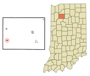
map_caption = Location in the state ofIndiana
mapsize1 =
map_caption1 =
subdivision_type = Country
subdivision_name =United States
area_note =
subdivision_type1 = State
subdivision_name1 =Indiana
subdivision_type2 = County
subdivision_name2 = Pulaski
subdivision_type3 = Township
subdivision_name3 = Salem
government_type =
leader_title =
leader_name =
established_date =
area_magnitude = 1 E5
area_total_km2 = 0.8
area_land_km2 = 0.8
area_water_km2 = 0.0
population_as_of = 2000
population_note =
population_total = 905
population_density_km2 = 1127.2
timezone = EST
utc_offset = -5
timezone_DST = EST
utc_offset_DST = -5
area_total_sq_mi = 0.3
area_land_sq_mi = 0.3
area_water_sq_mi = 0.0
elevation_m = 207
elevation_ft = 679
latd = 40 |latm = 59 |lats = 9 |latNS = N
longd = 86 |longm = 53 |longs = 2 |longEW = W
postal_code_type =ZIP code
postal_code = 47946
area_code = 219
blank_name = FIPS code
blank_info = 18-25288GR|2
blank1_name = GNIS feature ID
blank1_info = 0434752GR|3
footnotes =
website =Francesville is a town in Salem Township, Pulaski County,
Indiana ,United States . The population was 905 at the 2000 census.Geography
Francesville is located at coor dms|40|59|9|N|86|53|2|W|city (40.985858, -86.883868)GR|1.
According to the
United States Census Bureau , the town has a total area of 0.3square mile s (0.8km² ), all of it land.Demographics
As of the
census GR|2 of 2000, there were 905 people, 357 households, and 252 families residing in the town. Thepopulation density was 2,954.7 people per square mile (1,127.2/km²). There were 383 housing units at an average density of 1,250.4/sq mi (477.0/km²). The racial makeup of the town was 97.68% White, 0.11% African American, 0.22% Asian, 0.33% from other races, and 1.66% from two or more races. Hispanic or Latino of any race were 1.33% of the population.There were 357 households out of which 33.9% had children under the age of 18 living with them, 59.7% were married couples living together, 7.8% had a female householder with no husband present, and 29.4% were non-families. 26.3% of all households were made up of individuals and 13.4% had someone living alone who was 65 years of age or older. The average household size was 2.54 and the average family size was 3.09.
In the town the population was spread out with 27.5% under the age of 18, 6.6% from 18 to 24, 27.4% from 25 to 44, 20.4% from 45 to 64, and 18.0% who were 65 years of age or older. The median age was 37 years. For every 100 females there were 94.6 males. For every 100 females age 18 and over, there were 91.3 males.
The median income for a household in the town was $39,464, and the median income for a family was $43,438. Males had a median income of $30,000 versus $20,341 for females. The
per capita income for the town was $16,469. About 3.3% of families and 4.2% of the population were below thepoverty line , including 2.2% of those under age 18 and 2.8% of those age 65 or over.References
External links

Wikimedia Foundation. 2010.