- Kingsbury, Indiana
Infobox Settlement
official_name = Town of Kingsbury, Indiana
settlement_type =Town
nickname =
mapsize = 250x200px
imagesize =
image_caption =
imagesize =
image_caption =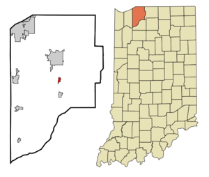
map_caption = Location in the state ofIndiana
mapsize1 =
map_caption1 =
subdivision_type = Country
subdivision_name =United States
area_footnotes =
unit_pref = Imperial
subdivision_type1 = State
subdivision_name1 =Indiana
subdivision_type2 = County
subdivision_name2 = LaPorte
subdivision_type3 = Township
subdivision_name3 = Washington
government_type =
leader_title =
leader_name =
established_date =
area_magnitude = 1 E6
area_total_km2 = 1.5
area_land_km2 = 1.5
area_water_km2 = 0.0
population_as_of = 2000
population_note =
population_total = 229
population_density_km2 = 152.4
timezone = CST
utc_offset = -6
timezone_DST = CDT
utc_offset_DST = -5
area_total_sq_mi = 0.6
area_land_sq_mi = 0.6
area_water_sq_mi = 0.0
elevation_m = 228
elevation_ft = 748
latd = 41 |latm = 31 |lats = 36 |latNS = N
longd = 86 |longm = 42 |longs = 2 |longEW = W
postal_code_type =ZIP code
postal_code = 46345
area_code = 219
blank_name = FIPS code
blank_info = 18-39816GR|2
blank1_name = GNIS feature ID
blank1_info = 0450442GR|3
footnotes =
website =Kingsbury is a town in Washington Township, LaPorte County,
Indiana , just northwest of the intersection ofU.S. Route 35 andU.S. Route 6 . The vacant Kingsbury Munitions plant, in use duringWorld War II , is just east of town. The population was 229 at the 2000 census. It is included in theMichigan City, Indiana -La Porte, Indiana Metropolitan Statistical Area .Geography
Kingsbury is located at coor dms |41|31|36|N|86|42|2|W.
According to the
United States Census Bureau , the town has a total area of 0.6square mile s (1.5km² ), all of it land.Demographics
As of the
census GR|2 of 2000, there were 229 people, 90 households, and 68 families residing in the town. Thepopulation density was 391.8 people per square mile (152.4/km²). There were 94 housing units at an average density of 160.8/sq mi (62.6/km²). The racial makeup of the town was 99.56% White and 0.44% Native American.There were 90 households out of which 25.6% had children under the age of 18 living with them, 62.2% were married couples living together, 10.0% had a female householder with no husband present, and 24.4% were non-families. 16.7% of all households were made up of individuals and 6.7% had someone living alone who was 65 years of age or older. The average household size was 2.54 and the average family size was 2.81.
In the town the population was spread out with 22.7% under the age of 18, 10.0% from 18 to 24, 29.3% from 25 to 44, 23.1% from 45 to 64, and 14.8% who were 65 years of age or older. The median age was 38 years. For every 100 females there were 81.7 males. For every 100 females age 18 and over, there were 84.4 males.
The median income for a household in the town was $50,000, and the median income for a family was $53,438. Males had a median income of $40,417 versus $22,500 for females. The
per capita income for the town was $18,096. About 4.6% of families and 9.7% of the population were below thepoverty line , including 10.9% of those under the age of eighteen and none of those sixty five or over.References
External links
Wikimedia Foundation. 2010.