- Amo, Indiana
Infobox Settlement
official_name = Town of Amo, Indiana
mapsize = 250x200px
settlement_type =Town
imagesize =
image_caption =
imagesize =
image_caption =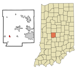
map_caption = Location in the state ofIndiana
mapsize1 =
map_caption1 =
subdivision_type = Country
subdivision_name =United States
area_note =
subdivision_type1 = State
subdivision_name1 =Indiana
subdivision_type2 = County
subdivision_name2 = Hendricks
subdivision_type3 = Township
subdivision_name3 = Clay
government_type =
leader_title =
leader_name =
established_date =
area_magnitude = 1 E6
area_total_km2 = 1.6
area_land_km2 = 1.6
area_water_km2 = 0.0
population_as_of = 2000
population_note =
population_total = 414
population_density_km2 = 262.0
timezone = EST
utc_offset = −5
timezone_DST = EST
utc_offset_DST = −5
area_total_sq_mi = 0.6
area_land_sq_mi = 0.6
area_water_sq_mi = 0.0
elevation_m = 251
elevation_ft = 823
latd = 39 |latm = 41 |lats = 19 |latNS = N
longd = 86 |longm = 36 |longs = 47 |longEW = W
postal_code_type =ZIP code
postal_code = 46103
area_code = 317
blank_name = FIPS code
blank_info = 18-01450GR|2
blank1_name = GNIS feature ID
blank1_info = 0430143GR|3
footnotes =
website =Amo is a town in Clay Township, Hendricks County,
Indiana ,United States . The population was 414 at the 2000 census.Geography
Amo is located at coor dms|39|41|19|N|86|36|47|W|city (39.688685, -86.612972)GR|1.
History
Education
Mill Creek West Elementary is located in Amo. It is one of two elementary schools within the Mill Creek Community School Corporation.
According to the
United States Census Bureau , the town has a total area of 0.6square mile s (1.6km² ), all of it land.Demographics
As of the
census GR|2 of 2000, there were 414 people, 147 households, and 113 families residing in the town. Thepopulation density was 679.1 people per square mile (262.0/km²). There were 154 housing units at an average density of 252.6/sq mi (97.5/km²). The racial makeup of the town was 99.52% White, 0.24% African American and 0.24% Native American.There were 147 households out of which 43.5% had children under the age of 18 living with them, 61.9% were married couples living together, 12.9% had a female householder with no husband present, and 23.1% were non-families. 16.3% of all households were made up of individuals and 9.5% had someone living alone who was 65 years of age or older. The average household size was 2.82 and the average family size was 3.20.
In the town the population was spread out with 31.6% under the age of 18, 6.5% from 18 to 24, 34.3% from 25 to 44, 15.5% from 45 to 64, and 12.1% who were 65 years of age or older. The median age was 32 years. For every 100 females there were 94.4 males. For every 100 females age 18 and over, there were 88.7 males.
The median income for a household in the town was $41,167, and the median income for a family was $41,083. Males had a median income of $35,313 versus $23,438 for females. The
per capita income for the town was $15,994. About 4.9% of families and 6.7% of the population were below thepoverty line , including 3.3% of those under age 18 and 5.9% of those age 65 or over.Town Seal
In 2000 the town celebrated its
sesquicentennial anniversary in combination with the Hoosier Millennium celebration. The town council authorized a contest to design and adopt the official "Town Seal" open to all residence and any student enrolled in a public institution within the town boundaries of Amo. Officials from the Hoosier Millennium committee at the 500 Festival Parade in downtownIndianapolis reviewed the forty-two submissions on May 27, 2000 and selected town resident, Randy Potts, submission.On June 3, 2000, U.S. Congressman and Gubernatorial candidate
David M. McIntosh presented the finalized Seal to the Amo Town Board during the Amo Annual Fish Fry.The Seal pictures the ol' Mill building with Mill Creek running to the left of the structure. A railroad track lies running to the skyline of Indianapolis next to a corn field. The Seal is finalized with a freshly plowed field depicting the agricultural influence of the community. The outer ring of the Seal states, "Town of Amo" and the year "1850" representing the town’s founding. [cite news | last = Town of Amo | title = Town of Amo Resolution AR 2000.06.03.1 | work = Town Records | date = 2000-06-02 ]
References
External links
* [http://mcchs.50webs.com Mill Creek Community Historical Society]
Wikimedia Foundation. 2010.