- Earl Park, Indiana
Infobox Settlement
official_name = Earl Park
other_name =
nickname =
settlement_type = Town
motto =
imagesize =
image_caption =
flag_size =
image_
seal_size =
image_shield =
shield_size =
image_blank_emblem =
blank_emblem_type =
blank_emblem_size =
imagesize =
image_caption =
flag_size =
image_
seal_size =
image_shield =
shield_size =
image_blank_emblem =
blank_emblem_type =
blank_emblem_size =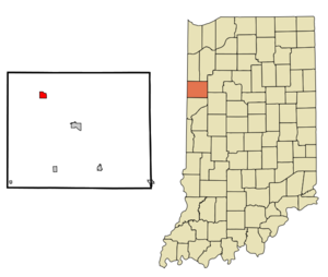
mapsize =
map_caption =
mapsize1 =
map_caption1 =
image_dot_
dot_mapsize =
dot_map_caption =
dot_x =
dot_y =
pushpin_
pushpin_label_position = right
pushpin_map_caption =
pushpin_mapsize =
subdivision_type = Country
subdivision_name =United States
subdivision_type1 = State
subdivision_name1 =Indiana
subdivision_type2 = County
subdivision_name2 = Benton
subdivision_type3 = Township
subdivision_name3 = Richland
government_footnotes =
government_type =
leader_title =
leader_name =
leader_title1 =
leader_name1 =
leader_title2 =
leader_name2 =
leader_title3 =
leader_name3 =
leader_title4 =
leader_name4 =
established_title =
established_date =
established_title2 =
established_date2 =
established_title3 =
established_date3 =
area_magnitude =
unit_pref =
area_footnotes =
unit_pref = Imperial
area_total_km2 = 2.4
area_land_km2 = 2.4
area_water_km2 = 0.0
area_total_sq_mi = 0.9
area_land_sq_mi = 0.9
area_water_sq_mi = 0.0
area_water_percent =
area_urban_km2 =
area_urban_sq_mi =
area_metro_km2 =
area_metro_sq_mi =
area_blank1_title =
area_blank1_km2 =
area_blank1_sq_mi =
population_as_of = 2006
population_footnotes =
population_note =
population_total = 462
population_density_km2 = 198.7
population_density_sq_mi = 514.5
population_metro =
population_density_metro_km2 =
population_density_metro_sq_mi =
population_urban =
population_density_urban_km2 =
population_density_urban_sq_mi =
population_blank1_title =
population_blank1 =
population_density_blank1_km2 =
population_density_blank1_sq_mi =
timezone = EST
utc_offset = -5
timezone_DST = EDT
utc_offset_DST = -4
latd = 40 |latm = 41 |lats = 4 |latNS = N
longd = 87 |longm = 24 |longs = 57 |longEW = W
elevation_footnotes = cite web|url=Gnis3|449649|title=USGS detail on Earl Park|accessdate=2007-10-03]
elevation_m = 246
elevation_ft = 807
postal_code_type = ZIP code
postal_code = 47942
area_code = 219
blank_name = FIPS code
blank_info = 18-19450GR|2
blank1_name = GNIS feature ID
blank1_info = 0449649GR|3
website =
footnotes =Earl Park is a town in Richland Township, Benton County,
Indiana ,United States . The population was 462 at the 2006 census.History
Earl Park was laid out July 31, 1872, by Adams D. Raub and named for his uncle, Adams Earl, one of the promoters of the Big Four railway from Lafayette to Kankakee. It consisted of 217 lots, the public sale of which on August 8 attracted some 2,000 people. Free lunch and free transportation on a special train of freight cars from Lafayette was provided. The town's first building was a grain elevator, the second the railway station. Elias Wees opened the first general store, providing residents with groceries and provisions.cite book
last = Birch
first = Jesse Setlington
title = History of Benton County and Historic Oxford
origyear = 1928
year = 1942
month =
publisher = Craw & Craw
location = Oxford, Indiana
pages = p. 202
chapter = Towns of the County ]Earl Park's first school, a one-story frame building, was erected around 1874 and expanded to a second story around 1878. The town gained a Catholic church in 1880, and a Methodist one in 1881, each costing about $2,500 to build and furnish.cite book
last = Mossman
first = Ed
title = Counties of Warren, Benton, Jasper and Newton, Indiana: Historical and Biographical
publisher = F. A. Battey & Co.
location = Chicago
date = 1883
chapter = History of Benton County: Past Events -- Present Condition]Earl Park is home to the first large wind energy farm in Indiana established in 2008.
Geography
Earl Park is located at coor dms|40|41|4|N|87|24|57|W|city (40.684428, -87.415872)GR|1 in Richland Township.
U.S. Route 52 skirts around the northeast edge of town, and theKankakee, Beaverville and Southern Railroad along the southwest. The Upper Sugar Creek flows to the town's north and west.According to the
United States Census Bureau , the town has a total area of 0.9square mile s (2.4km² ), all of it land.Demographics
As of the
census GR|2 of 2000, there were 485 people, 168 households, and 111 families residing in the town. Thepopulation density was 514.5 people per square mile (199.2/km²). There were 177 housing units at an average density of 187.8/sq mi (72.7/km²). The racial makeup of the town was 98.97% White, 0.21% African American, 0.82% from other races. Hispanic or Latino of any race were 1.03% of the population.There were 168 households out of which 40.5% had children under the age of 18 living with them, 48.2% were married couples living together, 12.5% had a female householder with no husband present, and 33.9% were non-families. 27.4% of all households were made up of individuals and 10.7% had someone living alone who was 65 years of age or older. The average household size was 2.57 and the average family size was 3.17.
In the town the population was spread out with 27.2% under the age of 18, 10.5% from 18 to 24, 26.2% from 25 to 44, 16.7% from 45 to 64, and 19.4% who were 65 years of age or older. The median age was 36 years. For every 100 females there were 94.0 males. For every 100 females age 18 and over, there were 83.9 males.
The median income for a household in the town was $32,981, and the median income for a family was $37,188. Males had a median income of $26,667 versus $22,875 for females. The
per capita income for the town was $14,369. About 8.7% of families and 10.4% of the population were below thepoverty line , including 15.2% of those under age 18 and none of those age 65 or over.References
External links
* [http://www.earlparkindiana.com EarlParkIndiana.com] Online Home of Earl Park, Indiana

Wikimedia Foundation. 2010.