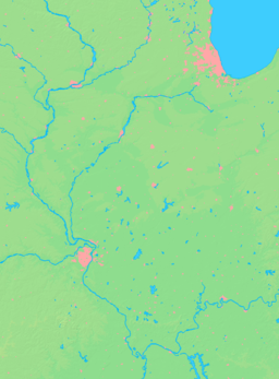
- Colp, Illinois
-
Colp Village Country United States State Illinois County Williamson Coordinates 37°48′21″N 89°4′45″W / 37.80583°N 89.07917°W Area 0.1 sq mi (0 km2) - land 0.1 sq mi (0 km2) Density 1,576.4 / sq mi (609 / km2) Timezone CST (UTC-6) - summer (DST) CDT (UTC-5) Postal code 62921 Area code 618 Wikimedia Commons: Colp, Illinois Colp is a village in Williamson County, Illinois, United States. The population was 224 at the 2000 census.
Contents
Geography
Colp is located at 37°48′21″N 89°04′45″W / 37.805768°N 89.079058°W.[1]
According to the United States Census Bureau, the village has a total area of 0.1 square miles (0.26 km2), all of it land.
History
Colp community leader Frank Caliper was one of the state's longest-serving elected officials. He served 52 years as mayor from 1935 until his death in 1987.[2]
Demographics
Historical populations Census Pop. %± 1920 584 — 1930 1,250 114.0% 1940 323 −74.2% 1950 253 −21.7% 1960 201 −20.6% 1970 271 34.8% 1980 278 2.6% 1990 235 −15.5% 2000 224 −4.7% 2010 225 0.4% U.S. Census[3] At the 2000 census[4], there were 224 people, 103 households and 60 families residing in the village. The population density was 1,576.4 per square mile (617.8/km²). There were 112 housing units at an average density of 788.2 per square mile (308.9/km²). The racial makeup of the village was 76.34% White, 21.43% African American, 0.89% Native American, 0.45% from other races, and 0.89% from two or more races.
There were 103 households of which 23.3% had children under the age of 18 living with them, 40.8% were married couples living together, 15.5% had a female householder with no husband present, and 40.8% were non-families. 33.0% of all households were made up of individuals and 12.6% had someone living alone who was 65 years of age or older. The average household size was 2.17 and the average family size was 2.75.
Age distribution was 22.8% under the age of 18, 10.3% from 18 to 24, 26.8% from 25 to 44, 21.9% from 45 to 64, and 18.3% who were 65 years of age or older. The median age was 38 years. For every 100 females there were 89.8 males. For every 100 females age 18 and over, there were 86.0 males.
The median household income was $14,722, and the median family income was $14,286. Males had a median income of $26,250 versus $11,875 for females. The per capita income for the village was $13,769. About 44.8% of families and 37.6% of the population were below the poverty line, including 53.3% of those under the age of eighteen and 25.0% of those sixty five or over.
References
- ^ "US Gazetteer files: 2010, 2000, and 1990". United States Census Bureau. 2011-02-12. http://www.census.gov/geo/www/gazetteer/gazette.html. Retrieved 2011-04-23.
- ^ Social Security Death Index. Rootsweb.com; and Jerry F. Costello. July 20, 2010. Congressional Record-Extensions of Remarks. Washington, D.C.: United States Congress. E1368. Online at http://www.gpo.gov/fdsys/pkg/CREC-2010-07-20/pdf/CREC-2010-07-20-extensions.pdf.
- ^ Census of Population and Housing, U.S. Census Bureau, http://www.census.gov/prod/www/abs/decennial/
- ^ "American FactFinder". United States Census Bureau. http://factfinder.census.gov. Retrieved 2008-01-31.
Municipalities and communities of Williamson County, Illinois Cities Carterville | Creal Springs | Herrin | Hurst | Johnston City | Marion‡
Villages Bush | Cambria | Colp | Crainville | Energy | Freeman Spur‡ | Pittsburg | Spillertown | Stonefort‡ | Whiteash
Precincts Blairsville | Carterville | Corinth | Crab Orchard | Creal Springs | East Marion | Grassy | Herrin | Lake Creek | Southern | Stonefort | West Marion
Unincorporated
communitiesAttila | Blairsville | Chittyville | Clifford | Corinth | Crab Orchard | Crenshaw Crossing | Dewmaine | Dykersburg | Egyptian Hills | Egyptian Shores | Ferges | Fergestown | Hafer | Lake Crest | New Camp | No. 9 | Old Camp | Paulton | Paineville | Pulleys Mill | Shakerag
Ghost towns Chamness | Halfway | Halfway (Little Juarez)
Footnotes ‡This populated place also has portions in an adjacent county or counties
Categories:- Villages in Illinois
- Populated places in Williamson County, Illinois
Wikimedia Foundation. 2010.


