- Lai da Curnera
-
Lai da Curnera 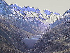
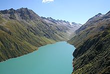
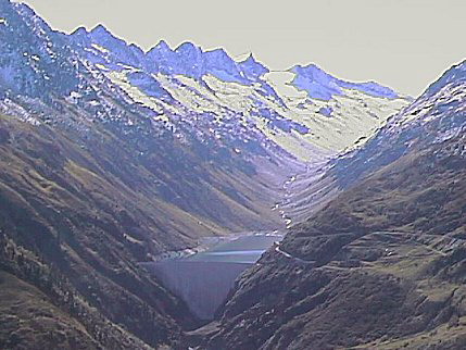
Location Grisons Coordinates 46°37′36″N 8°42′49″E / 46.62667°N 8.71361°ECoordinates: 46°37′36″N 8°42′49″E / 46.62667°N 8.71361°E Lake type reservoir Catchment area 24.1 km² Basin countries Switzerland Surface area 0.81 km² Max. depth 136 m Water volume 41.1 mio m³ Surface elevation 1956 m Lai da Curnera is a reservoir in the municipality of Tujetsch, in the Grisons, Switzerland. The reservoir is linked to Lai da Sontga Maria and Lai da Nalps in the neighboring valley. The lake's volume is 41.1 mio m³ and its surface area 0.81 km².
All surrounding rivers are diverted into the reservoir, among them the Rein da Tuma, coming from Lai da Tuma (Tomasee), near the Oberalp Pass and known as the source of the river Rhine[1]. The Vorderrhein, or Anterior Rhine as the Rhine is called in this area, passes just about 2 kilometers north to the barrier of the lake. A multiday trekking route is signposted along the young Rhine called Senda Sursilvana, from where the barrier can be spotted easily.[2]
 View South
References
- ^ [(English)Atlas der Schweiz Switzerland maps by Swiss Federal Office of Topography
- ^ [(English)Hiking Switzerland on Senda Sursilvana along young Rhine
External links
 Media related to Lai da Curnera at Wikimedia Commons
Categories:- Graubünden geography stubs
- Lakes of Switzerland
- Reservoirs in Switzerland
- Lakes of Graubünden

Wikimedia Foundation. 2010.