Bramhope — is a village and civil parish in the City of Leeds metropolitan borough, West Yorkshire, England, north of Holt Park and Cookridge, and north west of Horsforth.The village is 9 miles (14.4 km) north of Leeds City Centre. According to the 2001… … Wikipedia
Yeadon, West Yorkshire — infobox UK place country = England latitude= 53.8690 longitude= 1.6882 official name= Yeadon population = metropolitan borough= City of Leeds metropolitan county= West Yorkshire region= Yorkshire and the Humber constituency westminster= Pudsey… … Wikipedia
Otley — For other uses, see Otley (disambiguation). Coordinates: 53°54′18″N 1°41′13″W / 53.905°N 1.687°W / 53.905; 1.687 … Wikipedia
Cookridge — The Dale Parks from Moseley Wood area … Wikipedia
Adel, Leeds — Coordinates: 53°50′56″N 1°35′06″W / 53.8489°N 1.5849°W / 53.8489; 1.5849 … Wikipedia
Danny Care — Personal information Full name Daniel Stuart Care Date of birth January 2, 1987 (1987 01 02) (age 24) Place of birth Leeds … Wikipedia
Civil parishes in West Yorkshire — A map of West Yorkshire, showing the Metropolitan Boroughs: (1) Leeds; (2) Wakefield; (3) Kirklees; (4) Calderdale; and (5) Bradford. A civil parish is a subnational entity, forming the lowest unit of local government in England. There are 97… … Wikipedia
List of residences in Emmerdale — This is a list of residences in Emmerdale village and its surrounding area for ITV soap opera Emmerdale .urrounding areaHome Farm Home Farm is filmed at Creskeld Hall at Arthington, near Bramhope. Home Farm was once occupied by the Tate family,… … Wikipedia
List of places in Yorkshire — This is a list of cities, towns and villages in the historic English county of Yorkshire. See the list of places in England for places in other counties.See:List of civil parishes in the East Riding of Yorkshire, :List of civil parishes in North… … Wikipedia
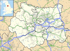
City of Leeds — For the local government district in existence from 1835 to 1974, see County Borough of Leeds. City of Leeds City Metropolitan borough … Wikipedia
 Old Bramhope
 Media related to Old Bramhope at Wikimedia CommonsCategories: