- Old Belses
-
Coordinates: 55°30′57″N 2°41′05″W / 55.515936°N 2.684697°W
Old Belses
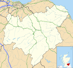
 Old Belses shown within the Scottish Borders
OS grid reference NT5624 Council area Scottish Borders Country Scotland Sovereign state United Kingdom Police Lothian and Borders Fire Lothian and Borders Ambulance Scottish EU Parliament Scotland List of places: UK • Scotland • Old Belses is a village by the Ale Water, in the Parish of Ancrum, in the Scottish Borders of Scotland, in the former Roxburghshire.
Other placenames relating to Belses include Belses Mill, Belses Muir, New Belses.
Belses was a station on the Waverley Line.
See also
External links
Categories:- Villages in the Scottish Borders
- Scottish Borders geography stubs
Wikimedia Foundation. 2010.

