- Odstone
-
Coordinates: 52°39′N 1°25′W / 52.65°N 1.42°W
Odstone 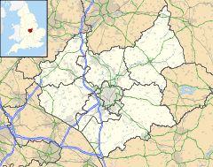
 Odstone
Odstone shown within LeicestershireOS grid reference SK3907 Shire county Leicestershire Region East Midlands Country England Sovereign state United Kingdom Police Leicestershire Fire Leicestershire Ambulance East Midlands EU Parliament East Midlands List of places: UK • England • Leicestershire Odstone is a hamlet forming part of the Shackerstone civil parish in the Hinckley and Bosworth district of Leicestershire, England. It stands on a marked promontory of high ground between two river valleys.
The village appears in the Domesday Book as Odeston, meaning either "Odd's farm or village", or "settlement on the protruding piece of land", oddr being the Old Norse for "point".[1] Many local towns and villages share a similar Scandinavian heritage.
References
- ^ Watts, Victor et. al., (2004) The Cambridge Dictionary of Place Names, Cambridge University Press, Cambridge. ISBN 0 521 36209 1
External links
Categories:- Hamlets in Leicestershire
- Leicestershire geography stubs

Wikimedia Foundation. 2010.