- Crary Mountains
-
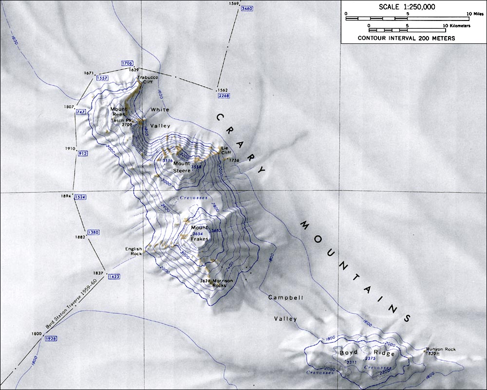
 Crary Mountains map
Crary Mountains (76°48′S 117°40′W / 76.8°S 117.667°W) is a group of ice-covered Antarctic mountains, 56 km (35 mi) long, rising to 3,655 m at Mount Frakes and including Mount Rees, Mount Steere and Boyd Ridge. The mountains are located 80 km (50 mi) SW of Toney Mountain in Marie Byrd Land.
The mountains were probably among those viewed by Admiral Byrd and other members of the USAS in plane flights from the ship Bear on Feb. 24 and 25, 1940. They were mapped in the course of the 1957-58 oversnow traverse from Byrd Station to the Sentinel Range led by C.R. Bentley, and named after Albert P. Crary, who was then Deputy Chief Scientist for the US-IGY Antarctic Program.
References

This Marie Byrd Land location article is a stub. You can help Wikipedia by expanding it.