- Drayton, Worcestershire
-
Coordinates: 52°22′43″N 2°08′40″W / 52.37856°N 2.144523°W
Drayton 
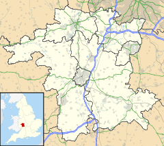
 Drayton shown within Worcestershire
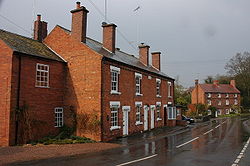
District Wyre Forest Shire county Worcestershire Region West Midlands Country England Sovereign state United Kingdom Post town Stourbridge Postcode district DY9 Police West Mercia Fire Hereford and Worcester Ambulance West Midlands EU Parliament West Midlands List of places: UK • England • Worcestershire Drayton is a village in Worcestershire, England.
Towns Villages Areley Kings • Astley Cross • Axborough • Blakedown • Blakeshall • Bliss Gate • Broome • Caunsall • Chaddesley Corbett • Churchill • Clows Top • Cookley • Drayton • Franche • Heightington • Kingsford • Ribbesford • Rock • Rushock • Shenstone • Stone • Tanwood • Upper Arley • WolverleyCivil parishes Categories:- Villages in Worcestershire
- Worcestershire geography stubs
Wikimedia Foundation. 2010.

