- Tetonia, Idaho
Infobox Settlement
official_name = Tetonia, Idaho
settlement_type =City
nickname =
motto =
imagesize =
image_caption =
image_
imagesize =
image_caption =
image_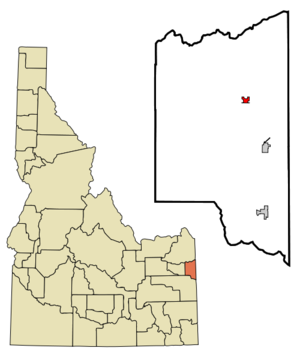
mapsize = 250px
map_caption = Location of Tetonia, Idaho
mapsize1 =
map_caption1 =subdivision_type = Country
subdivision_name =United States
subdivision_type1 = State
subdivision_name1 =Idaho
subdivision_type2 = County
subdivision_name2 = Teton
government_footnotes =
government_type =
leader_title =
leader_name =
leader_title1 =
leader_name1 =
established_title =
established_date =area_footnotes =
unit_pref = Imperial
area_magnitude =
area_total_km2 = 1.3
area_land_km2 = 1.3
area_water_km2 = 0.0
area_total_sq_mi = 0.5
area_land_sq_mi = 0.5
area_water_sq_mi = 0.0population_as_of = 2000
population_footnotes =
population_total = 247
population_density_km2 = 188.1
population_density_sq_mi = 487.2timezone = Mountain (MST)
utc_offset = -7
timezone_DST = MDT
utc_offset_DST = -6
elevation_footnotes =
elevation_m = 1843
elevation_ft = 6047
latd = 43 |latm = 48 |lats = 50 |latNS = N
longd = 111 |longm = 9 |longs = 35 |longEW = Wpostal_code_type =
ZIP code s
postal_code = 83424, 83452
area_code = 208
blank_name = FIPS code
blank_info = 16-80470
blank1_name = GNIS feature ID
blank1_info = 0398229
website =
footnotes =Tetonia is a city in Teton County,
Idaho ,United States . The population was 247 at the 2000 census. It is part of the Jackson, WY-ID Micropolitan Statistical Area.Geography
Tetonia is located at coor dms|43|48|50|N|111|9|35|W|city (43.813918, -111.159690)GR|1.
According to the
United States Census Bureau , the city has a total area of 0.5square mile s (1.3km² ), all of it land.Demographics
As of the
census GR|2 of 2000, there were 247 people, 87 households, and 64 families residing in the city. Thepopulation density was 487.2 people per square mile (187.0/km²). There were 98 housing units at an average density of 193.3/sq mi (74.2/km²). The racial makeup of the city was 93.12% White, 0.81% Native American, 0.40% Pacific Islander, 5.26% from other races, and 0.40% from two or more races. Hispanic or Latino of any race were 8.91% of the population.There were 87 households out of which 46.0% had children under the age of 18 living with them, 57.5% were married couples living together, 10.3% had a female householder with no husband present, and 25.3% were non-families. 21.8% of all households were made up of individuals and 4.6% had someone living alone who was 65 years of age or older. The average household size was 2.84 and the average family size was 3.29.
In the city the population was spread out with 36.0% under the age of 18, 8.9% from 18 to 24, 31.2% from 25 to 44, 14.6% from 45 to 64, and 9.3% who were 65 years of age or older. The median age was 28 years. For every 100 females there were 107.6 males. For every 100 females age 18 and over, there were 105.2 males.
The median income for a household in the city was $42,500, and the median income for a family was $42,679. Males had a median income of $35,455 versus $22,500 for females. The
per capita income for the city was $17,100. About 4.5% of families and 3.9% of the population were below thepoverty line , including 2.6% of those under the age of eighteen and 21.1% of those sixty five or over.Trivia
There is a street in Tetonia named after State Senator Dick Egbert, who married Alta Phillips, one of the daughters of Milton Edward Phillips, who was one of the founders of Tetonia and was also a state senator.
References
External links
Wikimedia Foundation. 2010.