- Chamelecón
-
Chamelecón 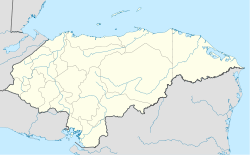
 Chamelecón
Coordinates: 15°23′0″N 88°1′0″W / 15.383333°N 88.016667°WCoordinates: 15°23′0″N 88°1′0″W / 15.383333°N 88.016667°W Country  Honduras
Departament Cortés Government – Mayor Chamelecón is a suburb of San Pedro Sula in Honduras.
It came to world attention on 23 December 2004 when 28 people were murdered and another 28 injured while returning from the centre of San Pedro Sula by the MS-13 gang opposed to the (proposed) restoration of the death penalty in Honduras. Many of the residents of this poor suburb work in clothing factories.
See also
References
Categories:- Populated places in Honduras
- Honduras geography stubs

Wikimedia Foundation. 2010.