- Reynolds, Georgia
Infobox Settlement
official_name = Reynolds, Georgia
other_name =
native_name =
nickname =
settlement_type =Town
motto =
imagesize =
image_caption =
flag_size =
image_
seal_size =
image_shield =
shield_size =
image_blank_emblem =
blank_emblem_type =
blank_emblem_size =
imagesize =
image_caption =
flag_size =
image_
seal_size =
image_shield =
shield_size =
image_blank_emblem =
blank_emblem_type =
blank_emblem_size =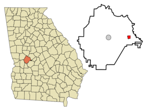
mapsize = 250px
map_caption = Location in Taylor County and the state of Georgia
mapsize1 =
map_caption1 =
image_dot_
dot_mapsize =
dot_map_caption =
dot_x =
dot_y =
pushpin_
pushpin_label_position =
pushpin_map_caption =
pushpin_mapsize =
subdivision_type = Country
subdivision_name =United States
subdivision_type1 = State
subdivision_name1 = Georgia
subdivision_type2 = County
subdivision_name2 = Taylor
subdivision_type3 =
subdivision_name3 =
subdivision_type4 =
subdivision_name4 =
government_footnotes =
government_type =
leader_title =
leader_name =
leader_title1 =
leader_name1 =
leader_title2 =
leader_name2 =
leader_title3 =
leader_name3 =
leader_title4 =
leader_name4 =
established_title =
established_date =
established_title2 =
established_date2 =
established_title3 =
established_date3 =
area_magnitude =
unit_pref = Imperial
area_footnotes =
area_total_km2 = 3.4
area_land_km2 = 3.4
area_water_km2 = 0
area_total_sq_mi = 1.3
area_land_sq_mi = 1.3
area_water_sq_mi = 0
area_water_percent =
area_urban_km2 =
area_urban_sq_mi =
area_metro_km2 =
area_metro_sq_mi =
area_blank1_title =
area_blank1_km2 =
area_blank1_sq_mi =
population_as_of = 2000
population_footnotes =
population_note =
population_total = 1036
population_density_km2 = 304.7
population_density_sq_mi = 796.9
population_metro =
population_density_metro_km2 =
population_density_metro_sq_mi =
population_urban =
population_density_urban_km2 =
population_density_urban_sq_mi =
population_blank1_title =
population_blank1 =
population_density_blank1_km2 =
population_density_blank1_sq_mi =
timezone = Eastern (EST)
utc_offset = -5
timezone_DST = EDT
utc_offset_DST = -4
latd = 32 |latm = 33 |lats = 33 |latNS = N
longd = 84 |longm = 5 |longs = 44 |longEW = W
elevation_footnotes =
elevation_m = 134
elevation_ft = 440
postal_code_type =ZIP code
postal_code = 31076
area_code = 478
blank_name = FIPS code
blank_info = 13-64876GR|2
blank1_name = GNIS feature ID
blank1_info = 0321535GR|3
website =
footnotes =Reynolds is a town in Taylor County, Georgia,
United States . The population was 1,036 at the 2000 census.Geography
According to the
United States Census Bureau , the town has a total area of 1.3square mile s (3.4km² ), of which, 1.3 square miles (3.4 km²) of it is land and 0.75% is water. The town was said to have been settled first by Dr. Alfred Coleman. In 1853 it became the town of Reynolds, although the origin of its name is unknown. The Coleman Institute Catalog said that it was named for John Reynolds, one of Georgia's famous governors, while another source said it was named for the superintendent of the railroad at the time. The earliest recorded minutes of the City of Reynolds found in the City Hall are datedJanuary 10 1913.Demographics
As of the
census GR|2 of 2000, there were 1,036 people, 447 households, and 289 families residing in the town. Thepopulation density was 784.9 people per square mile (303.0/km²). There were 495 housing units at an average density of 375.0/sq mi (144.8/km²). The racial makeup of the town was 48.84% White, 50.58% African American, 0.39% Asian, and 0.19% from two or more races. Hispanic or Latino of any race were 0.77% of the population.There were 447 households out of which 23.0% had children under the age of 18 living with them, 41.4% were married couples living together, 19.7% had a female householder with no husband present, and 35.3% were non-families. 32.7% of all households were made up of individuals and 14.3% had someone living alone who was 65 years of age or older. The average household size was 2.32 and the average family size was 2.95.
In the town the population was spread out with 22.9% under the age of 18, 6.6% from 18 to 24, 23.9% from 25 to 44, 28.1% from 45 to 64, and 18.5% who were 65 years of age or older. The median age was 42 years. For every 100 females there were 81.4 males. For every 100 females age 18 and over, there were 76.4 males.
The median income for a household in the town was $25,347, and the median income for a family was $30,179. Males had a median income of $37,917 versus $20,500 for females. The
per capita income for the town was $16,071. About 17.9% of families and 23.5% of the population were below thepoverty line , including 29.7% of those under age 18 and 25.0% of those age 65 or over.References
Wikimedia Foundation. 2010.