- Lumpkin, Georgia
Infobox Settlement
official_name = Lumpkin, Georgia
other_name =
native_name =
nickname =
settlement_type =City
motto =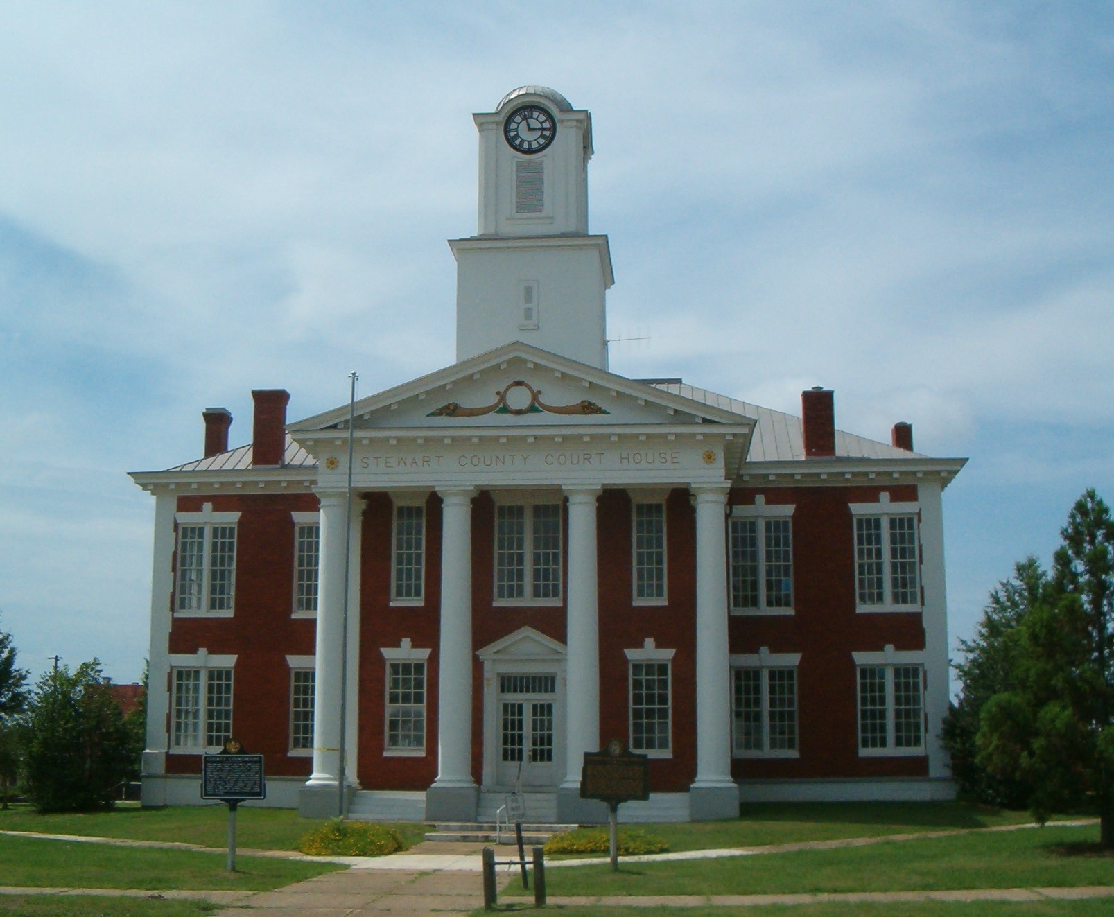
imagesize =
image_caption = Stewart County Courthouse in Lumpkin, GA
flag_size =
image_
seal_size =
image_shield =
shield_size =
image_blank_emblem =
blank_emblem_type =
blank_emblem_size =
flag_size =
image_
seal_size =
image_shield =
shield_size =
image_blank_emblem =
blank_emblem_type =
blank_emblem_size =
mapsize = 250px
map_caption = Location in Stewart County and the state of Georgia
mapsize1 =
map_caption1 =
image_dot_
dot_mapsize =
dot_map_caption =
dot_x =
dot_y =
pushpin_
pushpin_label_position =
pushpin_map_caption =
pushpin_mapsize =
subdivision_type = Country
subdivision_name =United States
subdivision_type1 = State
subdivision_name1 = Georgia
subdivision_type2 = County
subdivision_name2 = Stewart
subdivision_type3 =
subdivision_name3 =
subdivision_type4 =
subdivision_name4 =
government_footnotes =
government_type =
leader_title =
leader_name =
leader_title1 =
leader_name1 =
leader_title2 =
leader_name2 =
leader_title3 =
leader_name3 =
leader_title4 =
leader_name4 =
established_title =
established_date =
established_title2 =
established_date2 =
established_title3 =
established_date3 =
area_magnitude =
unit_pref = Imperial
area_footnotes =
area_total_km2 = 4.1
area_land_km2 = 4.1
area_water_km2 = 0
area_total_sq_mi = 1.6
area_land_sq_mi = 1.6
area_water_sq_mi = 0
area_water_percent =
area_urban_km2 =
area_urban_sq_mi =
area_metro_km2 =
area_metro_sq_mi =
area_blank1_title =
area_blank1_km2 =
area_blank1_sq_mi =
population_as_of = 2000
population_footnotes =
population_note =
population_total = 1369
population_density_km2 = 333.9
population_density_sq_mi = 855.6
population_metro =
population_density_metro_km2 =
population_density_metro_sq_mi =
population_urban =
population_density_urban_km2 =
population_density_urban_sq_mi =
population_blank1_title =
population_blank1 =
population_density_blank1_km2 =
population_density_blank1_sq_mi =
timezone = Eastern (EST)
utc_offset = -5
timezone_DST = EDT
utc_offset_DST = -4
latd = 32 |latm = 2 |lats = 59 |latNS = N
longd = 84 |longm = 47 |longs = 45 |longEW = W
elevation_footnotes =
elevation_m = 183
elevation_ft = 600
postal_code_type =ZIP code
postal_code = 31815
area_code = 229
blank_name = FIPS code
blank_info = 13-47980GR|2
blank1_name = GNIS feature ID
blank1_info = 0317484GR|3
website =
footnotes =Lumpkin is a city in, and the
county seat of, Stewart County, Georgia,United States . The population was 1,369 at the 2000 census.GR|6History
Lumpkin was incorporated on
March 30 ,1829 . It was formerly the Randolph county seat, but became the Stewart county seat when it split from Randolph in1830 . The city was named in honor ofWilson Lumpkin , a two-termgovernor of Georgia . His namesake county is at the other end of the state.Geography
Lumpkin is located at coor dms|32|2|59|N|84|47|45|W|city (32.049638, -84.795859)GR|1.
According to the
United States Census Bureau , the city has a total area of 1.6square mile s (4.1km² ), of which, 1.6 square miles (4.1 km²) of it is land and 0.04 square miles (0.1 km²) of it (1.25%) is water.Elected officials
Weyman E. ("Ed") Cannington, Jr. is the
mayor of Lumpkin, Georgia, first elected in November 1979. Mayor Cannington is past president of theGeorgia Municipal Association .*Council Members: Randy Mathis, Kenneth Seay, Laurence Young, Jimmy Lynch, Jean Beall Armour, and Charles Gibson
*City Administrator: Jim Murray
*City Clerk: Marianna WilliamsDemographics
As of the
census GR|2 of 2000, there were 1,369 people, 552 households, and 367 families residing in the city. Thepopulation density was 862.2 people per square mile (332.4/km²). There were 621 housing units at an average density of 391.1/sq mi (150.8/km²). The racial makeup of the city was 28.85% White, 70.42% African American, 0.29% Native American, and 0.44% from two or more races. Hispanic or Latino of any race were 0.66% of the population.There were 552 households out of which 29.7% had children under the age of 18 living with them, 34.4% were married couples living together, 26.3% had a female householder with no husband present, and 33.5% were non-families. 28.8% of all households were made up of individuals and 14.3% had someone living alone who was 65 years of age or older. The average household size was 2.48 and the average family size was 3.08.
In the city the population was spread out with 27.4% under the age of 18, 7.4% from 18 to 24, 27.4% from 25 to 44, 21.3% from 45 to 64, and 16.5% who were 65 years of age or older. The median age was 36 years. For every 100 females there were 89.3 males. For every 100 females age 18 and over, there were 77.2 males.
The median income for a household in the city was $22,315, and the median income for a family was $27,321. Males had a median income of $22,422 versus $20,250 for females. The
per capita income for the city was $16,146. About 24.2% of families and 26.7% of the population were below thepoverty line , including 35.7% of those under age 18 and 18.3% of those age 65 or over.References
External links
Wikimedia Foundation. 2010.