- Woodbury, Georgia
Infobox Settlement
official_name = Woodbury, Georgia
other_name =
native_name =
nickname =
settlement_type =City
motto =
imagesize =
image_caption =
flag_size =
image_
seal_size =
image_shield =
shield_size =
image_blank_emblem =
blank_emblem_type =
blank_emblem_size =
imagesize =
image_caption =
flag_size =
image_
seal_size =
image_shield =
shield_size =
image_blank_emblem =
blank_emblem_type =
blank_emblem_size =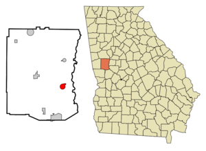
mapsize = 250px
map_caption = Location in Meriwether County and the state of Georgia
mapsize1 =
map_caption1 =
image_dot_
dot_mapsize =
dot_map_caption =
dot_x =
dot_y =
pushpin_
pushpin_label_position =
pushpin_map_caption =
pushpin_mapsize =
subdivision_type = Country
subdivision_name =United States
subdivision_type1 = State
subdivision_name1 = Georgia
subdivision_type2 = County
subdivision_name2 = Meriwether
subdivision_type3 =
subdivision_name3 =
subdivision_type4 =
subdivision_name4 =
government_footnotes =
government_type =
leader_title =
leader_name =
leader_title1 =
leader_name1 =
leader_title2 =
leader_name2 =
leader_title3 =
leader_name3 =
leader_title4 =
leader_name4 =
established_title =
established_date =
established_title2 =
established_date2 =
established_title3 =
established_date3 =
area_magnitude =
unit_pref = Imperial
area_footnotes =
area_total_km2 = 5.2
area_land_km2 = 5.2
area_water_km2 = 0
area_total_sq_mi = 2
area_land_sq_mi = 2
area_water_sq_mi = 0
area_water_percent =
area_urban_km2 =
area_urban_sq_mi =
area_metro_km2 =
area_metro_sq_mi =
area_blank1_title =
area_blank1_km2 =
area_blank1_sq_mi =
population_as_of = 2000
population_footnotes =
population_note =
population_total = 1184
population_density_km2 = 227.7
population_density_sq_mi = 592
population_metro =
population_density_metro_km2 =
population_density_metro_sq_mi =
population_urban =
population_density_urban_km2 =
population_density_urban_sq_mi =
population_blank1_title =
population_blank1 =
population_density_blank1_km2 =
population_density_blank1_sq_mi =
timezone = Eastern (EST)
utc_offset = -5
timezone_DST = EDT
utc_offset_DST = -4
latd = 32 |latm = 58 |lats = 50 |latNS = N
longd = 84 |longm = 34 |longs = 52 |longEW = W
elevation_footnotes =
elevation_m = 252
elevation_ft = 827
postal_code_type =ZIP code
postal_code = 30293
area_code = 706
blank_name = FIPS code
blank_info = 13-83896GR|2
blank1_name = GNIS feature ID
blank1_info = 0333457GR|3
website =
footnotes =Woodbury is a city in Meriwether County, Georgia,
United States . The population was 1,184 at the 2000 census.History
Woodbury is one of the oldest towns in Meriwether County. It grew up about ten miles southeast of Greenville in the late 1820's. It was first named Sandtown for the white sand that covered the ground. When the post office opened in 1845, the PO department changed the name to Woodberry. By 1854, the spelling was officially changed to Woodbury. The small town of Woodbury hit a growth spurt in 1887 when the railroad laid its tracks and made its mark. Around the turn of the century Woodbury had temendous growth with schools, churches, and businesses serving the many new residents.
Geography
Woodbury is located at coor dms|32|58|50|N|84|34|52|W|city (32.980588, -84.580979)GR|1.
According to the
United States Census Bureau , the city has a total area of 2.0square mile s (5.2km² ), of which, 2.0 square miles (5.2 km²) of it is land and 0.50% is water.Demographics
As of the
census GR|2 of 2000, there were 1,184 people, 454 households, and 302 families residing in the city. Thepopulation density was 588.7 people per square mile (227.4/km²). There were 499 housing units at an average density of 248.1/sq mi (95.9/km²). The racial makeup of the city was 42.40% White, 56.50% African American, and 1.10% from two or more races. Hispanic or Latino of any race were 0.68% of the population.There were 454 households out of which 27.5% had children under the age of 18 living with them, 37.7% are married couples living.together, 22.9% had a female householder with no husband present, and 33.3% were non-families. 30.8% of all households were made up of individuals and 17.4% had someone living alone who was 65 years of age or older. The average household size was 2.61 and the average family size was 3.31.
In the city the population was spread out with 24.7% under the age of 18, 10.3% from 18 to 24, 23.1% from 25 to 44, 25.1% from 45 to 64, and 16.8% who were 65 years of age or older. The median age was 38 years. For every 100 females there were 86.8 males. For every 100 females age 18 and over, there were 81.7 males.
The median income for a household in the city was $26,339, and the median income for a family was $31,389. Males had a median income of $26,563 versus $18,287 for females. The
per capita income for the city was $12,162. About 24.8% of families and 25.4% of the population were below thepoverty line , including 33.2% of those under age 18 and 24.9% of those age 65 or over.References
External links
Wikimedia Foundation. 2010.