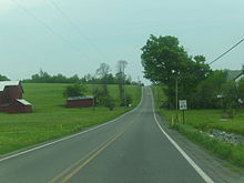
- Pennsylvania Route 296
-
PA Route 296 Route information Maintained by PennDOT Length: 16.23 mi[1] (26.12 km) Existed: 1936 – present Major junctions South end:  PA 191 in Lake Ariel
 PA 196 in Lake Township
 US 6 in Waymart
North end:  PA 247 in Clinton Township
Location Counties: Wayne Highway system Roads in Pennsylvania
Interstate • US • State • Legislative←  PA 295
PA 299  →
→Pennsylvania Route 296 (designated by the Pennsylvania Department of Transportation as SR 296) is an 16.23-mile (26.12 km) long state highway located in Wayne County in Pennsylvania. The southern terminus is at Route 191 in Lake Ariel. The northern terminus is at Route 247 in Clinton Township.
Contents
Route description
Route 296 begins at an intersection on a curve with Route 191 (Lake Ariel Highway) in downtown Lake Ariel, Pennsylvania. The route progresses northward through Lake Ariel as Gravity Road, passing a stretch of commercial businesses, which soon becomes residential for the stretch north of Lake Ariel. Just before the intersection with Paradise Lane, Route 296 curves to the northeast, winding its way through Lake Township. The residential road becomes further developed before intersection with Tisdel Road. At that intersection, Route 296 and Gravity Road turn on the right-of-way for Tisdel and head northwest into the hamlet of Gravity. That soon changes to Varden, where after several curves, Route 296 intersects with the northern terminus of Route 196 (the Easton Turnpike).[2]
After crossing the northern terminus of Route 196, Route 296 approaches a local ponds and makes several winds to the north. The highway makes a long northwestern stretch through fields into South Canaan Township and soon into the hamlet of South Canaan. Now carrying the moniker of the Easton Turnpike, Route 296 leaves the residential hamlet after passing the local school. Curving north past the Red Maples Golf Club, the route becomes primarily rural and curves northward in different directions several times through South Canaan Township. Route 296 enters the borough of Waymart, crossing the Owego Turnpike and passing near Lake Leodore before intersecting with U.S. Route 6 (Grand Army of the Republic Highway / Roosevelt Highway). Route 296 continues northward out of Waymart and becomes the Belmont Turnpike through Clinton Township. The route passes Elk Lake, turning northeastward through woodlands. After White Oak Pond, Route 296 makes a curve to the northeast and intersects with Route 247 (Creamton Drive). As Route 247 takes over the right-of-way of the Belmont Turnpike, this serves as the northern terminus for Route 296.[2]
Major intersections
The entire route is in Wayne County.
Location Mile[1] Destinations Notes Lake Ariel 0.00  PA 191 (Lake Ariel Highway)
Southern terminus of Route 296. Lake Township 7.74  PA 196 (Eaton Turnpike)
Northern terminus of Route 196. Waymart 13.64  US 6 (Grand Army of the Republic Highway / Roosevelt Highway)
Clinton Township 16.23  PA 247 (Belmont Turnpike / Creamton Road)
Northern terminus of Route 296. 1.000 mi = 1.609 km; 1.000 km = 0.621 mi References
- ^ a b Yahoo! Inc. Yahoo! Maps – Overview map of Pensnylvania Route 296 (Map). Cartography by NAVTEQ. http://maps.yahoo.com/#mvt=m&lat=41.559818&lon=-75.372604&zoom=12&q1=41.453504%2C-75.38359&w0=41.472573364876816%2C-75.38131713867188&q2=41.483154%2C-75.395349&w1=&q3=41.588391%2C-75.408223&w2=&q4=41.669804%2C-75.405734. Retrieved June 2, 2011.
- ^ a b Microsoft. Map of Overview map of Pennsylvania Route 296 – Bing Maps (Map). Cartography by NavTEQ, Inc. http://www.bing.com/maps/#Y3A9NDEuNTYyMDM4MzQwODI5NDQ2fi03NS4zOTYwODk5ODQ0NzkmbHZsPTExJnN0eT1yJnJ0cD1wb3MuNDEuNDUzNTQ5NjY1NTk1NDI1Xy03NS4zODM1Mzg2NzgyODg0NV9uZWFyJTIwTGFrZSUyMEFyaWVsJTIwSHd5JTJDJTIwTGFrZSUyMEFyaWVsJTJDJTIwUEElMjAxODQzNl9fX2FffnBvcy40MS41ODg3MDA1MzU4OTA1Ml8tNzUuNDA4NjQxMjkwNjY5NThfbmVhciUyMDEwNSUyMEJlbG1vbnQlMjBUcGtlJTJDJTIwV2F5bWFydCUyQyUyMFBBJTIwMTg0NzJfX19hX35wb3MuNDEuNjcwMjIwMDcyNTk0NzY2Xy03NS40MDYwMjU2NDgxMTcwN19fX19hXyZtb2RlPUQmcnRvcD0wfjB+MH4=. Retrieved June 5, 2011.
External links
- Kitsko, Jeffrey J. (2011). "PA 296". Pennsylvania Highways. http://www.pahighways.com/state/PA251-300.html#PA118. Retrieved June 2, 2011.
- Prince, Adam J. (2002). "PA 296". State-Ends.com. http://www.state-ends.com/paends/state/296.html. Retrieved June 2, 2011.
Categories:- State highways in Pennsylvania
- Transportation in Wayne County, Pennsylvania
Wikimedia Foundation. 2010.


