- McCrea, Louisiana
-
McCrea is a small, unincorporated community on the east bank of the Atchafalaya River in the northwestern portion of Pointe Coupee Parish, Louisiana (USA). it is located along Louisiana Highway 417, some distance north of East Krotz Springs, Louisiana. A post office opened here in 1902 but was discontinued in 1954. The community is named for Bob McCrea, an early settler who developed a plantation at the site prior to the Civil War.
McCrea is famous as the location of the last levee breach or "crevasse" of the Great Flood of 1927. As the high water of that year accumulated within the Atchafalaya River to unprecedented heights, authorities were concerned that the Mississippi River itself was attempting to shift its channel into that of the Atchafalaya. Some 2,000 men - free labor and state convicts - labored for weeks under government supervision to prevent a breach, but the McCrea levee broke at 3:15 a.m. on May 24, 1927, flooding much of Pointe Coupee, West Baton Rouge, Iberville and Assumption Parishes and forcing more than 10,000 residents from their homes.
After the floodwaters receded, a new levee was built inland from the old one, curving around the crater created by the break. That body of water has since been known as McCrea Lake.
In June 1971, McCrea was the site of a sort of "mini-Woodstock," rock festival. More than 50,000 rock fans from around the nation converged on the hamlet for the "Celebration of Life" rock concert held between the levee and the Atchafalaya River. The concert was billed to last for eight days. In literally a matter of hours, the rock festival more than doubled the population of Pointe Coupee Parish. Rain, the lack of accommodations and sanitary facilities and public outrage at the actions of some of the attendees resulted in the festival ending earlier than scheduled. Two people drowned in the fast-rushing Atchafalaya River. Undercover police officers made more than 100 drug busts, and one person died from a drug overdose. Some of the acts that were scheduled to play at the concert included: Pink Floyd, Ike & Tina Turner, the Beach Boys, Boz Scaggs, Chuck Berry, B. B. King, Melanie, Brownsville Station, Stephen Stills & Neil Young, Country Joe McDonald, and John Sebastian[1].
References
- ^ Lockhart, John M. "Roadmap to the Westside", The Riverside Reader, January 21, 2008, p. 1
Municipalities and communities of Pointe Coupee Parish, Louisiana City 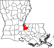
Towns Village Unincorporated
communitiesGhost towns Alma | Anchor | East Krotz Springs | Elliot City | False River | Hermitage | Parlange | Red River Landing | Torras | Waterloo
Coordinates: 30°52′09″N 91°47′22″W / 30.86917°N 91.78944°W
Categories:- Louisiana geography stubs
- Populated places in Pointe Coupee Parish, Louisiana
- Unincorporated communities in Louisiana
- Baton Rouge metropolitan area

Wikimedia Foundation. 2010.