Chenal, Louisiana

Chenal, Louisiana
Chenal
Unincorporated community
Country United States
State Louisiana
Coordinates 30°36′45″N 91°22′47″W / 30.6125°N 91.37972°W / 30.6125; -91.37972
Timezone CST (UTC-6)
 - summer (DST) CDT (UTC-5)
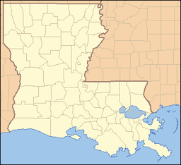
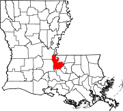
Location of Chenal in Louisiana
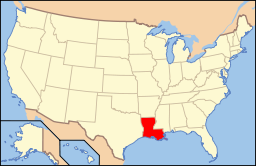
Location of Louisiana in the United States

Chenal (pronounced Sh Nahl) is an unincorporated community located in southeastern Pointe Coupee Parish, Louisiana, United States. The word "chenal" is the French word for "channel". The community takes its name from a body of water located just south of it. This body of water known as "the Chenal" or "le chenal" is a remnant of the Old Mississippi River channel that once flowed through the area. This channel as well as nearby False River were once parts of the main channel of the Mississippi.

History

The first church to be known in this area as Our Lady of the Immaculate Conception was established in the area as a mission in 1853. The church later burned down and was relocated to its current site in Lakeland, Louisiana. The site of the original church, in the area still known as Chenal, is the current location of the Chenal Cemetery.

A post office was established in Chenal in 1892. This post office closed down in 1951 when a new post office was set up in Rougon, to service both communities[1].

Geography

It is situated west of the Mississippi River, along Louisiana Highway 414. It is nearly due north of the nearby community of Rougon, Louisiana.

References

  1. ^ Lockhart, John M. "Roadmap to the Westside", The Riverside Reader, January 21, 2008, p. 1

Wikimedia Foundation. 2010.

Игры ⚽ Поможем написать курсовую

Look at other dictionaries:

  • Louisiana Highway 414 — Infobox LA Highway type=State route=414 length mi=10.7 length km= formed=1955 renumbering dir1=West dir2=East from=LA 413 junction= to=LA 413 previous type=State previous route=413 next type=State next route=415 Louisiana Highway 414 (LA 414) is… …   Wikipedia

  • National Register of Historic Places listings in Pointe Coupee Parish, Louisiana — Location of Pointe Coupee Parish in Louisiana This is a list of the National Register of Historic Places listings in Pointe Coupee Parish, Louisiana. This is intended to be a complete list of the properties on the National Register of Historic… …   Wikipedia

  • New Roads, Louisiana — Coordinates: 30°41′47″N 91°26′20″W / 30.69639°N 91.43889°W / 30.69639; 91.43889 …   Wikipedia

  • Morganza, Louisiana — Coordinates: 30°44′08″N 91°36′36″W / 30.73556°N 91.61°W / 30.73556; 91.61 …   Wikipedia

  • Oscar, Louisiana — Coordinates: 30°37′15″N 91°27′03″W / 30.62083°N 91.45083°W / 30.62083; 91.45083 …   Wikipedia

  • McCrea, Louisiana — McCrea is a small, unincorporated community on the east bank of the Atchafalaya River in the northwestern portion of Pointe Coupee Parish, Louisiana (USA). it is located along Louisiana Highway 417, some distance north of East Krotz Springs,… …   Wikipedia

  • Mix, Louisiana — Mix is an unincorporated community in Pointe Coupee Parish, Louisiana, United States. It is the home of the Parlange Plantation House, a National Historic Landmark. It is located along Louisiana Highway 1, south of New Roads, Louisiana. Mix is… …   Wikipedia

  • Dupont, Pointe Coupee Parish, Louisiana — Dupont is an unincorporated community in southeastern Pointe Coupee Parish, Louisiana, United States. The community is located along Louisiana Highway 413, north of the community of Jarreau. The area falls under the service of the nearby Jarreau… …   Wikipedia

  • Little Rock, Arkansas — Little Rock redirects here. For other uses, see Little Rock (disambiguation). City of Little Rock, Arkansas   City   …   Wikipedia

  • Louisiane (Nouvelle-France) — Pour les articles homonymes, voir Louisiane (homonymie). Louisiane Louisiana (en) 1682 – 1762 1800 – 1803 …   Wikipédia en Français

Share the article and excerpts

Direct link
Do a right-click on the link above
and select “Copy Link”