- Ringgold, Georgia
Infobox Settlement
official_name = Ringgold, Georgia
other_name =
native_name =
nickname =
settlement_type =City
motto =
imagesize =
image_caption =
flag_size =
image_
seal_size =
image_shield =
shield_size =
image_blank_emblem =
blank_emblem_type =
blank_emblem_size =
imagesize =
image_caption =
flag_size =
image_
seal_size =
image_shield =
shield_size =
image_blank_emblem =
blank_emblem_type =
blank_emblem_size =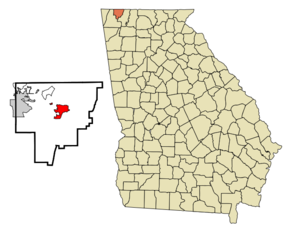
mapsize = 250px
map_caption = Location in Catoosa County and the state of Georgia
mapsize1 =
map_caption1 =
image_dot_
dot_mapsize =
dot_map_caption =
dot_x =
dot_y =
pushpin_
pushpin_label_position =
pushpin_map_caption =
pushpin_mapsize =
subdivision_type = Country
subdivision_name =United States
subdivision_type1 = State
subdivision_name1 = Georgia
subdivision_type2 = County
subdivision_name2 = Catoosa
subdivision_type3 =
subdivision_name3 =
subdivision_type4 =
subdivision_name4 =
government_footnotes =
government_type =
leader_title = Mayor
leader_name = Joe Barger
leader_title1 =
leader_name1 =
leader_title2 =
leader_name2 =
leader_title3 =
leader_name3 =
leader_title4 =
leader_name4 =
established_title =
established_date =
established_title2 =
established_date2 =
established_title3 =
established_date3 =
area_magnitude =
unit_pref = Imperial
area_footnotes =
area_total_km2 = 10.2
area_land_km2 = 10.2
area_water_km2 = 0
area_total_sq_mi = 3.9
area_land_sq_mi = 3.9
area_water_sq_mi = 0
area_water_percent =
area_urban_km2 =
area_urban_sq_mi =
area_metro_km2 =
area_metro_sq_mi =
area_blank1_title =
area_blank1_km2 =
area_blank1_sq_mi =
population_as_of = 2000
population_footnotes =
population_note =
population_total = 2422
population_density_km2 = 237.5
population_density_sq_mi = 621
population_metro =
population_density_metro_km2 =
population_density_metro_sq_mi =
population_urban =
population_density_urban_km2 =
population_density_urban_sq_mi =
population_blank1_title =
population_blank1 =
population_density_blank1_km2 =
population_density_blank1_sq_mi =
timezone = Eastern (EST)
utc_offset = -5
timezone_DST = EDT
utc_offset_DST = -4
latd = 34 |latm = 55 |lats = 2 |latNS = N
longd = 85 |longm = 6 |longs = 57 |longEW = W
elevation_footnotes =
elevation_m = 237
elevation_ft = 778
postal_code_type =ZIP code
postal_code = 30736
area_code = 706
blank_name = FIPS code
blank_info = 13-65324GR|2
blank1_name = GNIS feature ID
blank1_info = 0329441GR|3
website =
footnotes =Ringgold is a city in Catoosa County, Georgia,
United States . The population was 2,422 at the 2000 census. The city is thecounty seat of Catoosa CountyGR|6. Ringgold is part of the Chattanooga, TN–GA Metropolitan Statistical Area.The city was named after Samuel Ringgold, a hero of the
Battle of Palo Alto in theU.S.-Mexican War .Ringgold is where the locomotive "General" stopped during the great locomotive chase on
April 12 1862 . Ringgold is also home to the historic Ringgold Depot which still contains bullet marks from theCivil War .On
March 14 2002 , a sudden heavy fog played havoc with morning traffic and contributed to one of the worst traffic pileups in history; 125 vehicles crashed on Interstate 75 and 4 people died.The city also gained some notoriety for erecting a display that included the Ten Commandments, the Lord's Prayer, and a third blank frame. The stated purpose of the third frame was to include alternate beliefs, but the city agreed to remove the display as part of a settlement of complaints.
Country-western singerDolly Parton 's husband, Carl Dean, is from Ringgold, and the couple was married at the Ringgold 1st Baptist Church.George Jones andTammy Wynette were also married in Ringgold. The city has traditionally been a "marriage center" because of the short waiting time after blood tests; one testing laboratory in the community offers a combination test/wedding package and sells clocks with the inscription "I got married in Ringgold, Ga."Geography
Ringgold is located at coor dms|34|55|2|N|85|6|57|W|city (34.917170, -85.115698)GR|1.
According to the
United States Census Bureau , the city has a total area of 3.9square mile s (10.2km² ), of which, 3.9 square miles (10.2 km²) of it is land and 0.25% is water.Demographics
As of the
census GR|2 of 2000, there were 2,422 people, 1,033 households, and 644 families residing in the city. Thepopulation density was 617.0 people per square mile (237.9/km²). There were 1,116 housing units at an average density of 284.3/sq mi (109.6/km²). The racial makeup of the city was 91.33% White, 6.32% African American, 0.25% Native American, 0.50% Asian, 0.58% from other races, and 1.03% from two or more races. Hispanic or Latino of any race were 1.82% of the population.There were 1,033 households out of which 30.3% had children under the age of 18 living with them, 41.6% were married couples living together, 17.1% had a female householder with no husband present, and 37.6% were non-families. 32.5% of all households were made up of individuals and 13.5% had someone living alone who was 65 years of age or older. The average household size was 2.25 and the average family size was 2.85.
In the city the population was spread out with 23.9% under the age of 18, 11.6% from 18 to 24, 29.8% from 25 to 44, 19.8% from 45 to 64, and 14.9% who were 65 years of age or older. The median age was 34 years. For every 100 females there were 88.9 males. For every 100 females age 18 and over, there were 86.7 males.
The median income for a household in the city was $26,834, and the median income for a family was $35,132. Males had a median income of $26,943 versus $21,074 for females. The
per capita income for the city was $15,612. About 14.5% of families and 16.7% of the population were below thepoverty line , including 26.1% of those under age 18 and 6.4% of those age 65 or over.References
External links
* [http://www.cityofringgold.com/ City of Ringgold GA official website]
Wikimedia Foundation. 2010.