- Barwick, Georgia
Infobox Settlement
official_name = Barwick, Georgia
other_name =
native_name =
nickname =
settlement_type =Town
motto =
imagesize =
image_caption =
flag_size =
image_
seal_size =
image_shield =
shield_size =
image_blank_emblem =
blank_emblem_type =
blank_emblem_size =
imagesize =
image_caption =
flag_size =
image_
seal_size =
image_shield =
shield_size =
image_blank_emblem =
blank_emblem_type =
blank_emblem_size =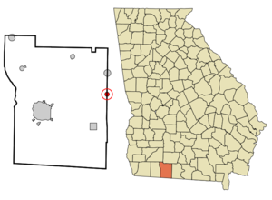
mapsize = 250px
map_caption = Location in Thomas County and the state of Georgia
mapsize1 =
map_caption1 =
image_dot_
dot_mapsize =
dot_map_caption =
dot_x =
dot_y =
pushpin_
pushpin_label_position =
pushpin_map_caption =
pushpin_mapsize =
subdivision_type = Country
subdivision_name =United States
subdivision_type1 = State
subdivision_name1 = Georgia
subdivision_type2 = Counties
subdivision_name2 = Thomas, Brooks
subdivision_type3 =
subdivision_name3 =
subdivision_type4 =
subdivision_name4 =
government_footnotes =
government_type =
leader_title =
leader_name =
leader_title1 =
leader_name1 =
leader_title2 =
leader_name2 =
leader_title3 =
leader_name3 =
leader_title4 =
leader_name4 =
established_title =
established_date =
established_title2 =
established_date2 =
established_title3 =
established_date3 =
area_magnitude =
unit_pref = Imperial
area_footnotes =
area_total_km2 = 2
area_land_km2 = 1.9
area_water_km2 = 0.1
area_total_sq_mi = 0.8
area_land_sq_mi = 0.8
area_water_sq_mi = 0
area_water_percent =
area_urban_km2 =
area_urban_sq_mi =
area_metro_km2 =
area_metro_sq_mi =
area_blank1_title =
area_blank1_km2 =
area_blank1_sq_mi =
population_as_of = 2000
population_footnotes =
population_note =
population_total = 444
population_density_km2 = 222
population_density_sq_mi = 555
population_metro =
population_density_metro_km2 =
population_density_metro_sq_mi =
population_urban =
population_density_urban_km2 =
population_density_urban_sq_mi =
population_blank1_title =
population_blank1 =
population_density_blank1_km2 =
population_density_blank1_sq_mi =
timezone = Eastern (EST)
utc_offset = -5
timezone_DST = EDT
utc_offset_DST = -4
latd = 30 |latm = 53 |lats = 32 |latNS = N
longd = 83 |longm = 44 |longs = 18 |longEW = W
elevation_footnotes =
elevation_m = 81
elevation_ft = 266
postal_code_type =ZIP code
postal_code = 31720
area_code = 229
blank_name = FIPS code
blank_info = 13-05708GR|2
blank1_name = GNIS feature ID
blank1_info = 0310835GR|3
website =
footnotes =Barwick is a town divided by the county line between Brooks County and Thomas County, Georgia,
United States . It is part of theValdosta, Georgia Metropolitan Statistical Area.The population was 444 at the 2000 census – 328 of the town's 444 residents (73.9%) lived in Thomas County and 116 (26.1%) in Brooks County. [cite web | url = http://www.census.gov/popest/cities/files/SUB-EST2006_13.csv | title = Subcounty population estimates: Georgia 2000-2006| format = CSV | publisher =United States Census Bureau , Population Division | date =2007-06-28 | accessdate = 2007-10-11]Geography
Barwick is located at coor dms|30|53|32|N|83|44|18|W|city (30.892087, -83.738400)GR|1.
According to the
United States Census Bureau , the town has a total area of 0.8square mile s (2.0km² ), of which, 0.8 square miles (1.9 km²) of it is land and 0.04 square miles (0.1 km²) of it (3.85%) is water.Demographics
As of the
census GR|2 of 2000, there were 444 people, 181 households, and 110 families residing in the town. Thepopulation density was 591.1 people per square mile (228.6/km²). There were 205 housing units at an average density of 272.9/sq mi (105.5/km²). The racial makeup of the town was 47.07% White, 49.77% African American, 0.90% Asian, 1.80% from other races, and 0.45% from two or more races. Hispanic or Latino of any race were 3.38% of the population.There were 181 households out of which 24.9% had children under the age of 18 living with them, 40.9% were married couples living together, 16.0% had a female householder with no husband present, and 39.2% were non-families. 35.9% of all households were made up of individuals and 19.9% had someone living alone who was 65 years of age or older. The average household size was 2.45 and the average family size was 3.25.
In the town the population was spread out with 29.3% under the age of 18, 8.8% from 18 to 24, 22.3% from 25 to 44, 22.7% from 45 to 64, and 16.9% who were 65 years of age or older. The median age was 35 years. For every 100 females there were 90.6 males. For every 100 females age 18 and over, there were 81.5 males.
The median income for a household in the town was $19,000, and the median income for a family was $21,250. Males had a median income of $26,806 versus $20,000 for females. The
per capita income for the town was $11,091. About 41.7% of families and 42.3% of the population were below thepoverty line , including 63.0% of those under age 18 and 24.6% of those age 65 or over.References
External links
Wikimedia Foundation. 2010.