- Baxley, Georgia
Infobox Settlement
official_name = Baxley, Georgia
other_name =
native_name =
nickname =
settlement_type =City
motto =
imagesize =
image_caption =
flag_size =
image_
seal_size =
image_shield =
shield_size =
image_blank_emblem =
blank_emblem_type =
blank_emblem_size =
imagesize =
image_caption =
flag_size =
image_
seal_size =
image_shield =
shield_size =
image_blank_emblem =
blank_emblem_type =
blank_emblem_size =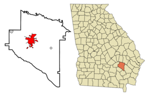
mapsize = 250px
map_caption = Location in Appling County and the state of Georgia
mapsize1 =
map_caption1 =
image_dot_
dot_mapsize =
dot_map_caption =
dot_x =
dot_y =
pushpin_
pushpin_label_position =
pushpin_map_caption =
pushpin_mapsize =
subdivision_type = Country
subdivision_name =United States
subdivision_type1 = State
subdivision_name1 = Georgia
subdivision_type2 = County
subdivision_name2 = Appling
subdivision_type3 =
subdivision_name3 =
subdivision_type4 =
subdivision_name4 =
government_footnotes =
government_type =
leader_title =
leader_name =
leader_title1 =
leader_name1 =
leader_title2 =
leader_name2 =
leader_title3 =
leader_name3 =
leader_title4 =
leader_name4 =
established_title =
established_date =
established_title2 =
established_date2 =
established_title3 =
established_date3 =
area_magnitude =
unit_pref = Imperial
area_footnotes =
area_total_km2 = 18.5
area_land_km2 = 18.5
area_water_km2 = 0
area_total_sq_mi = 7.2
area_land_sq_mi = 7.2
area_water_sq_mi = 0
area_water_percent =
area_urban_km2 =
area_urban_sq_mi =
area_metro_km2 =
area_metro_sq_mi =
area_blank1_title =
area_blank1_km2 =
area_blank1_sq_mi =
population_as_of = 2000
population_footnotes =
population_note =
population_total = 4150
population_density_km2 = 224.3
population_density_sq_mi = 584.5
population_metro =
population_density_metro_km2 =
population_density_metro_sq_mi =
population_urban =
population_density_urban_km2 =
population_density_urban_sq_mi =
population_blank1_title =
population_blank1 =
population_density_blank1_km2 =
population_density_blank1_sq_mi =
timezone = Eastern (EST)
utc_offset = -5
timezone_DST = EDT
utc_offset_DST = -4
latd = 31 |latm = 46 |lats = 31 |latNS = N
longd = 82 |longm = 20 |longs = 51 |longEW = W
elevation_footnotes =
elevation_m = 62
elevation_ft = 203
postal_code_type =ZIP code s
postal_code = 31513, 31515
area_code = 912
blank_name = FIPS code
blank_info = 13-06016GR|2
blank1_name = GNIS feature ID
blank1_info = 0331106GR|3
website =
footnotes =Baxley is a city in Appling County, Georgia,
United States . The population was 4,150 at the 2000 census. The city is thecounty seat of Appling CountyGR|6.Geography
Baxley is located at coor dms|31|46|31|N|82|20|51|W|city (31.775152, -82.347520)GR|1. Baxley is approximately 42
miles (67km ) E ofDouglas, Georgia and 47 miles (75 km) N ofWaycross, Georgia .According to the
United States Census Bureau , the city has a total area of 7.2square mile s (18.5km² ), all of it land.Demographics
As of the
census GR|2 of 2000, there were 4,150 people, 1,567 households, and 1,048 families residing in the city. Thepopulation density was 580.7 people per square mile (224.1/km²). There were 1,866 housing units at an average density of 261.1/sq mi (100.8/km²). The racial makeup of the city was 57.28% White, 37.93% African American, 0.22% Native American, 0.60% Asian, 3.16% from other races, and 0.82% from two or more races. Hispanic or Latino of any race were 7.23% of the population.There were 1,567 households out of which 33.2% had children under the age of 18 living with them, 43.3% were married couples living together, 18.5% had a female householder with no husband present, and 33.1% were non-families. 28.9% of all households were made up of individuals and 13.4% had someone living alone who was 65 years of age or older. The average household size was 2.56 and the average family size was 3.15.
In the city the population was spread out with 27.6% under the age of 18, 10.4% from 18 to 24, 26.7% from 25 to 44, 20.8% from 45 to 64, and 14.5% who were 65 years of age or older. The median age was 35 years. For every 100 females there were 91.1 males. For every 100 females age 18 and over, there were 84.9 males.
The median income for a household in the city was $24,441, and the median income for a family was $30,648. Males had a median income of $28,087 versus $16,250 for females. The
per capita income for the city was $14,321. About 21.6% of families and 24.4% of the population were below thepoverty line , including 31.0% of those under age 18 and 26.3% of those age 65 or over.Economy
The Edwin I. Hatch nuclear plant is located north of the city along U.S. Route 1, on the banks of the
Altamaha River . It is the area's largest employer.Education
Appling County High School Notable residents and natives
*Baxley was the home of
Caroline Miller , Georgia's firstPulitzer Prize -winning author. She received the award for "Lamb in his Bosom" in 1934.*Baxley is also the birthplace of
Janisse Ray and setting of her memoir "Ecology of a Cracker Childhood".Baxley in popular culture
Baxley was mentioned in
Charlie Daniels ' "Open Letter to the Hollywood Bunch". It stated "Go down to Baxley, Georgia and hold an anti-war rally and see what the folks down there think about you."References
External links
*Official City Website: [http://www.baxley.org Baxley.org]
Wikimedia Foundation. 2010.