Georgia State Route 57 — Infobox road state=GA type= route=57 length mi= length ref= [http://www.dot.state.ga.us/DOT/plan prog/transportation data/400reports/2002/dpp444 2002.pdf] length round=2 established= direction a=West direction b=East starting terminus= junction=… … Wikipedia
Georgia State Route 119 — infobox road state=GA type=GA route=119 length mi=81.3 length round=1 length ref= [cite map|url=http://maps.google.com/maps?f=d saddr=S+Costal+Hwy%2FUS 17+%4031.743940,+ 81.440033 daddr=GA 119+%4031.798280,+ 81.645030+to:GA 119+%4031.852573,+… … Wikipedia
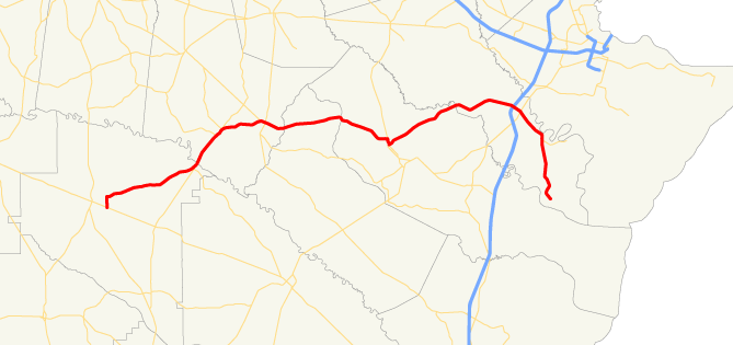
Georgia State Route 18 — Infobox road state=GA type= route=18 length mi= 144.56 length ref= [http://www.dot.state.ga.us/DOT/plan prog/transportation data/400reports/2002/dpp444 2002.pdf] length round=2 established= direction a=West direction b=East starting terminus=… … Wikipedia
California State Route 1 — For other uses, see CA1 (disambiguation). State Route 1 Route information … Wikipedia
List of highways numbered 144 — Highways numbered 144 include: This list is incomplete; you can help by expanding it. Canada Ontario Highway 144 United States … Wikipedia
Liste der State-, U.S.- und Interstate-Highways in Georgia — Dies ist eine Aufstellung von State Routes, U.S. Highways und Interstates im US Bundesstaat Georgia, nach Nummern. Inhaltsverzeichnis 1 State Routes 1.1 Gegenwärtige Strecken 1.2 Außer Dienst gestellte Strecken … Deutsch Wikipedia
Liberty County, Georgia — Location in the state of Georgia … Wikipedia
State highways in Colorado — The standard Colorado state highway sign. The top half is the flag of Colorado. Highway names Interstates: Interstate X (I X) US Routes: U.S. Highway X (US X) … Wikipedia
Marion County, Georgia — For counties with a similar name, see Marion County (disambiguation). Marion County, Georgia Location in the state of Georgia … Wikipedia
List of Maine State Routes — Standard markers of State Routes in Maine. Highway names Interstates: Interstate x (abbreviated I X) … Wikipedia