- Nochistlán de Mejía (municipality)
Infobox Settlement
official_name = Nochistlán de Mejía
other_name = Nochistlán
native_name =
nickname =
settlement_type = Municipality
motto =
imagesize =
image_caption =
flag_size =
image_
seal_size =
image_shield =
shield_size =
city_logo =
citylogo_size =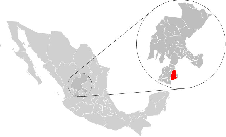
mapsize =
map_caption = Location of Nochistlán with inZacatecas and Mexico
mapsize1 =
map_caption1 =
image_dot_
dot_mapsize =
dot_map_caption =
dot_x = |dot_y =
pushpin_
pushpin_label_position =
pushpin_map_caption =
pushpin_mapsize =
subdivision_type = Country
subdivision_name = MEX
subdivision_type1 = State
subdivision_name1 =Zacatecas
subdivision_type2 = Municipal seat
subdivision_name2 =Nochistlán de Mejía
subdivision_type3 = Largest City
subdivision_name3 = Nochistlán de Mejía
subdivision_type4 =
subdivision_name4 =
government_footnotes =
government_type =
leader_title = Municipal President
leader_name = nowrap|C. Ramón Jiménez Fuentes PRD
leader_title1 =
leader_name1 =
leader_title2 =
leader_name2 =
leader_title3 =
leader_name3 =
leader_title4 =
leader_name4 =
established_title = Villa de Guadalajara (When settled by Spaniards)
established_date =1531 [ [http://www.nochistlan.gob.mx/historia.html Nochistlán Website's History Page] ]
established_title2 = Founded Municipality
established_date2 =1825
established_title3 =
established_date3 =
area_magnitude =
unit_pref =
area_footnotes =
area_total_km2 = 867
area_land_km2 =
area_water_km2 =
area_total_sq_mi =
area_land_sq_mi =
area_water_sq_mi =
area_water_percent =
area_urban_km2 =
area_urban_sq_mi =
area_metro_km2 =
area_metro_sq_mi =
area_blank1_title =
area_blank1_km2 =
area_blank1_sq_mi =
population_as_of = 2005
population_footnotes =
population_note =
population_total = 26195
population_density_km2 =
population_density_sq_mi =
population_metro =
population_density_metro_km2 =
population_density_metro_sq_mi =
population_urban =
population_density_urban_km2 =
population_density_urban_sq_mi =
population_blank1_title = Largest City
population_blank1 =15322
population_density_blank1_km2 =
population_density_blank1_sq_mi =
timezone = CST
utc_offset = =6
timezone_DST =
utc_offset_DST =
latd= 21|latm= 48|lats=03 |latNS= N
longd= 102|longm= 45|longs=57 |longEW= W
elevation_footnotes =
elevation_m =
elevation_ft =
postal_code_type = Postal Code
postal_code = 99900-99919
area_code =346
blank_name =
blank_info =
blank1_name =
blank1_info =
website =
footnotes =Nochistlán is one of the 58 municipalities in the
Mexican state ofZacatecas . Founded by the Caxcanes, it was also the first site of Guadalajara inMexico .Population
In the 2005 census the Municipality of Nochistlán reported a population of 26,195. [http://www.inegi.gob.mx/est/contenidos/espanol/sistemas/conteo2005/localidad/iter/ Link to tables of population data from Census of 2005] INEGI: Instituto Nacional de Estadística, Geografía e Informática] Of these, 15,322 lived in the municipal seat,
Nochistlán , and the remainder lived in surrounding rural communities.History
The first news that we have regarding the natives of these lands points to the Tecuexes. These people established settlements around
1000 A.D. Later in the12th century a new group of people moved in, these people were called Caxcanes and they were from the valley in Tuitlán, which is now found in theMunicipality of Villanueva , Zacatecas. The Caxcanes established Nochistlán by driving out the Tecuexes by force.Nuño Beltrán de Guzmán , onDecember 3 ,1531 , hiredJuan de Oñate to establish avillage in Nochistlán, (now a town in Zacatecas) the village would be named Guadalajara to honor Guzmán for having been born in Guadalajara.Guadalajara was founded in Nochistlán onJanuary 5 , having as officials Juan de Oñate, Sancho Ortiz de Zuñiga and Miguel Ibarra. They worked at this project for only 16 months and created the first layout of Guadalajara.Location
*Latitude 21°48'03" N
*Longitude 102°45'57" W
*Population 26, 195References
External links
* [http://www.nochistlan.gob.mx/index.htm Nochistlán Government Site (In Spanish)]
* [http://www.myspace.com/NochistlanZacatecas Nochistlán official MySpace
Wikimedia Foundation. 2010.