- Dassower See
-
Dassower See
Dassow Lake
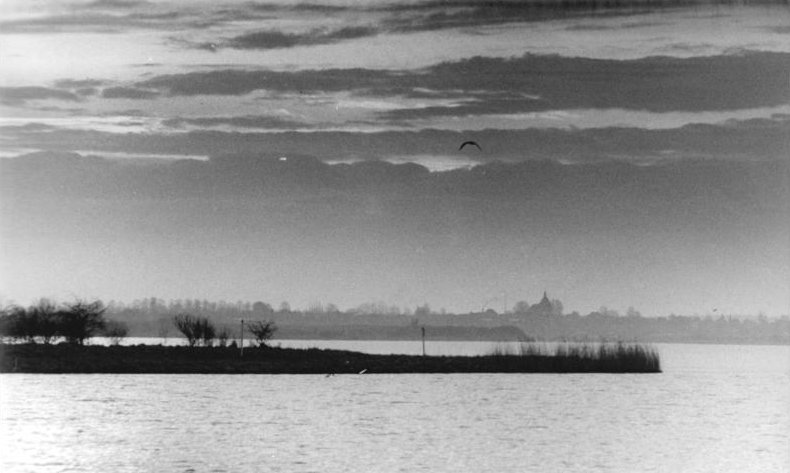
View of the lake in 1990. Location Northeast of Lübeck (Schleswig-Holstein) Coordinates 53°54′N 10°55′E / 53.9°N 10.917°ECoordinates: 53°54′N 10°55′E / 53.9°N 10.917°E Primary inflows Stepenitz Primary outflows Trave Basin countries Germany Max. length 8 km Surface area 8 km² Settlements Dassow The Dassower See (German for "Dassow lake") is a lake of the delta of Trave bay, northeast of Lübeck (Schleswig-Holstein) on the Baltic Sea.
The town of Dassow in the district Nordwestmecklenburg is the only large settlement at the lake bank. The Dassower See (Dassow Lake) is a side bay of the Trave, adjacent to the Baltic Sea. Despite its name, it is not a conventional lake, but a saltwater bay, which together with the Pötenitzer Wiek is almost fully cut off from the open sea and the Bay of Lübeck by the Priwall Peninsula. The approximately 8 km long Dassower See has a funnel-like form, which narrows itself in the west (delta into the River Trave) outgoing from the delta of the River Stepenitz in the east, again on approximately 300 m. The lake belonged to the city of Lübeck, and forms a part of the western border of Mecklenburg-Western Pomerania.
As home to approximately thirty kinds of ducks, the Dassower See is one of the largest bird sanctuaries in Germany. The lake provides refuge and is also an important racing and wintering area for Nordic water birds along with the two islands of grass and reeds. The entire bank range of the Dassower See and the lake stand have been under protection of the European Union since 1983.
Tourism and land development was not permitted until the German reunification, since the entire lakeshore range was a restricted area. The GDR had erected a several meters high wall on the bank, so the lake could not be seen from the GDR side. Entering the prohibited area was possible only with special permission. The border runs along the flood line, so that during normal water levels a narrow strip along the bank belongs to Schleswig-Holstein which was part of the Federal Republic. Thus, boat traffic near the Trave delta was possible without restrictions.
Schloss Lütgenhof is situated on the banks of the Dassower See. Moritz von Paepcke designed and built this castle in 1839. Mast-Jägermeister AG converted Schloss Lütgenhof to a restaurant and hotel with twenty-three rooms in 1999.
Literature
- Manfred Diehl, Dorothea Diehl: Naturschutzgebiete an der Ostseeküste Schleswig-Holsteins. In: Berichte des Vereins „Natur und Heimat“ und des Naturhistorischen Museums zu Lübeck. (Protected Areas of the Baltic Sea Coast of Schleswig-Holstein. In: Reports of the Association "Nature and Homeland" and the Nature-Historical Museum to Lübeck.) Heft (Number) 19/20, 1986, ISSN 0067-5806
Categories:- Lakes of Schleswig-Holstein
- Bays of Germany
- Lübeck
- Nature reserves in Schleswig-Holstein
Wikimedia Foundation. 2010.