- Hayden, Colorado
Infobox Settlement
official_name = Town of Hayden, Colorado
other_name =
native_name =
nickname =
settlement_type = Town
motto =
imagesize =
image_caption =
flag_size =
image_
seal_size =
image_shield =
shield_size =
image_blank_emblem =
blank_emblem_type =
blank_emblem_size =
imagesize =
image_caption =
flag_size =
image_
seal_size =
image_shield =
shield_size =
image_blank_emblem =
blank_emblem_type =
blank_emblem_size =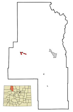
mapsize = 250px
map_caption = Location in Routt County and the state ofColorado
mapsize1 =
map_caption1 =
image_dot_
dot_mapsize =
dot_map_caption =
dot_x =
dot_y =
pushpin_
pushpin_label_position =
pushpin_map_caption =
pushpin_mapsize =
subdivision_type = Country
subdivision_name = USA
subdivision_type1 = State
subdivision_name1 = flag|Colorado
subdivision_type2 = Countycite web | url = http://www.dola.state.co.us/dlg/local_governments/municipalities.html | title = Active Colorado Municipalities | format =HTML | publisher = State of Colorado, Department of Local Affairs | accessdate = 2007-09-01]
subdivision_name2 = Routt
subdivision_type3 =
subdivision_name3 =
subdivision_type4 =
subdivision_name4 =
government_footnotes =
government_type = Statutory Town
leader_title =
leader_name =
leader_title1 =
leader_name1 =
leader_title2 =
leader_name2 =
leader_title3 =
leader_name3 =
leader_title4 =
leader_name4 =
established_title = Established
established_date = 1894
established_title2 = Incorporated (town)
established_date2 =May 5 ,1906 cite web | url = http://www.colorado.gov/dpa/doit/archives/muninc.html | title = Colorado Municipal Incorporations | format =HTML | publisher = State of Colorado, Department of Personnel & Administration, Colorado State Archives | date =2004-12-01 | accessdate = 2007-09-02]
established_title3 =
established_date3 =
area_magnitude =
unit_pref = Imperial
area_footnotes =
area_total_km2 = 6.4
area_land_km2 = 6.4
area_water_km2 = 0
area_total_sq_mi = 2.5
area_land_sq_mi = 2.5
area_water_sq_mi = 0
area_water_percent =
area_urban_km2 =
area_urban_sq_mi =
area_metro_km2 =
area_metro_sq_mi =
area_blank1_title =
area_blank1_km2 =
area_blank1_sq_mi =
population_as_of = 2000
population_footnotes =
population_note =
population_total = 1634
population_density_km2 = 255.3
population_density_sq_mi = 653.6
population_metro =
population_density_metro_km2 =
population_density_metro_sq_mi =
population_urban =
population_density_urban_km2 =
population_density_urban_sq_mi =
population_blank1_title =
population_blank1 =
population_density_blank1_km2 =
population_density_blank1_sq_mi =
timezone = MST
utc_offset = -7
timezone_DST = MDT
utc_offset_DST = -6
latd = 40 |latm = 29 |lats = 34 |latNS = N
longd = 107 |longm = 15 |longs = 19 |longEW = W
elevation_footnotes = GR|3
elevation_m = 1961
elevation_ft = 6434
postal_code_type =ZIP code cite web | url = http://zip4.usps.com/zip4/citytown.jsp | title = ZIP Code Lookup| format =JavaScript /HTML | publisher =United States Postal Service | accessdate = September 30 | accessyear = 2007]
postal_code = 81639
area_code = 970
blank_name = FIPS code
blank_info = 08-35070
blank1_name = GNIS feature ID
blank1_info = 0201992
website = [http://www.townofhayden.org/ Town of Hayden]
footnotes =Hayden is a Statutory Town in Routt County,
Colorado ,United States . The population was 1,634 at the 2000 census. The town sits alongU.S. Highway 40 in theYampa River between Craig and Steamboat Springs. Historically a center ofcoal mining andagriculture , it consists today of a small cluster of homes and businesses. The town is named forFerdinand Hayden , a surveyor who explored westernColorado during the late 19th century.Geography
Hayden is located at coor dms|40|29|34|N|107|15|19|W|city (40.492731, -107.255186)GR|1.
According to the
United States Census Bureau , the town has a total area of 2.5 square miles (6.4 km²), all of it land.Demographics
As of the
census GR|2 of 2000, there were 1,634 people, 618 households, and 443 families residing in the town. Thepopulation density was 664.1 people per square mile (256.5/km²). There were 658 housing units at an average density of 267.4/sq mi (103.3/km²). The racial makeup of the town was 96.02% White, 0.12% African American, 0.61% Native American, 0.12% Asian, 0.06% Pacific Islander, 1.96% from other races, and 1.10% from two or more races. Hispanic or Latino of any race were 5.69% of the population.There were 618 households out of which 42.1% had children under the age of 18 living with them, 57.1% were married couples living together, 9.4% had a female householder with no husband present, and 28.2% were non-families. 21.7% of all households were made up of individuals and 5.5% had someone living alone who was 65 years of age or older. The average household size was 2.63 and the average family size was 3.08.
In the town the population was spread out with 30.3% under the age of 18, 9.5% from 18 to 24, 33.1% from 25 to 44, 20.9% from 45 to 64, and 6.1% who were 65 years of age or older. The median age was 32 years. For every 100 females there were 104.5 males. For every 100 females age 18 and over, there were 100.2 males.
The median income for a household in the town was $42,147, and the median income for a family was $45,962. Males had a median income of $38,150 versus $23,359 for females. The
per capita income for the town was $18,574. About 5.4% of families and 7.0% of the population were below thepoverty line , including 8.2% of those under age 18 and 7.4% of those age 65 or over.History
The area was first settled in 1875, with the town established in 1894 and incorporated in 1906. Hayden was named for F.V. Hayden, head of a survey party for the U.S. Geological & Geographic Survey in the late 1860s.
References
External links
* [http://www.townofhayden.org/ Town of Hayden website]
** [http://www.dot.state.co.us/App_DTD_DataAccess/Downloads/CityMaps/Hayden.pdf CDOT map of the Town of Hayden]
Wikimedia Foundation. 2010.