- Oakland Point, Oakland, California
-
Coordinates: 37°48′27.9″N 122°18′15.98″W / 37.80775°N 122.3044389°W
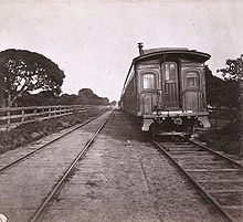 Historic photograph of a train at Oakland Point from 1860/1870 era
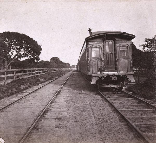
Oakland Point, in Oakland, California, USA, was the name of a small promontory on the eastern shore of San Francisco Bay located in the vicinity of what is now the Port of Oakland shipping terminal. Oakland Point was previously known as Gibbon's Point, named for an early American settler who constructed a small wharf there. The wharf and adjacent properties were acquired by the Central Pacific Railroad which subsequently constructed its own massive terminus for the Transcontinental Railroad, the Oakland Long Wharf.[1] This wharf in turn was later acquired and re-engineered as the Oakland Mole of the Southern Pacific Railroad. In addition to the wharf, the Central Pacific had a huge rail yard in the area which also later became one of the main rail yards of the Southern Pacific. Today, the same rail yard is operated by the Union Pacific Railroad.
The neighborhood near Oakland Point was initially known by the same name, although its identity was soon merged with the rest of West Oakland, the name by which it was known from the early 20th century onward. It was a thriving socially and ethnically mixed neighborhood from the late 19th century through the 1930s. Starting about the time of World War II and up to the present, the area became predominantly African American. African American men who worked as porters on the railroad had long lived in the area together with other ethnic groups, most of whom held other jobs with the railroad. World War II saw thousands of African Americans move into the Bay Area from the southern U.S. to work in the many local war industries, and many of them chose to live in the established community of African American railroad workers in West Oakland.
The name "Oakland Point" has been recently revived as part of the effort to re-develop West Oakland. It has been adopted by a community group calling itself the "Prescott-Oakland Point Neighborhood Association". Part of the redevelopment of the area includes, appropriately, the partial restoration of the historic 16th Street Station. The station will however, not be put to any railroad use, but will become the centerpiece of a housing development known as "Central Station".
See also
External links
- "Neighborhood Search Map". Oakland Museum of California. Archived from the original on 2009-04-30. http://web.archive.org/web/20090430211848/http://collections.museumca.org/search_map.jsp. Retrieved 2011-07-29.
References
- ^ Crofutt's New Overland Tourist, by George A. Crofutt, p 199 (1880), Google Book Search.
Oakland, California neighborhoods Downtown / Lake Merritt East Oakland Dimond District · Eastmont · Elmhurst · Fruitvale · Glenview · Grass Valley · Havenscourt · Laurel · Millsmont · Maxwell Park · Peralta Hacienda · Redwood Heights · Ridgemont · San Antonio · Seminary · Sequoyah Heights · Sobrante Park
North Oakland Bushrod Park · Golden Gate · Koreatown · Longfellow · Piedmont Avenue · Rockridge · Santa Fe · Temescal
West Oakland Acorn · Cypress Village · Dogtown · Ghost Town · Lower Bottoms · Oakland Point
Oakland Hills Claremont · Montclair · Piedmont Pines · Oakmore · Joaquin Miller Park · Mountain View Cemetery · Sequoyah Heights · Panoramic Hill
Categories:- Neighborhoods in Oakland, California
- Alameda County, California geography stubs
Wikimedia Foundation. 2010.